Categories in Murau
Gas StationTire ShopClothing storesMen's clothingShoe storesCatholic ChurchChapelClubPost OfficeHome Goods StorePhotographerTourist AttractionBars, pubs and tavernsCafesGrocery stores and supermarketsRestaurantsAtm'sBanksInsurance AgencyLawyerLegal and financialMedical PracticeBeauty salonsHair SalonBusiness to Business ServiceHoliday ApartmentHoliday Apartment RentalReal Estate AgencyShoppingBed and breakfastsChaletElectric Vehicle Charging StationHotels and motelsIndoor LodgingLodgingSelf-Catering AccommodationVacation Home Rental Agency
Industries
Business Distribution by Industry in Murau
| Industry Description | Number of Establishments |
|---|---|
| Other accommodation | 52 |
| Shopping | 34 |
| Health and medical | 30 |
| Construction of buildings | 24 |
| Restaurants | 18 |
| Financial services | 17 |
| Religion | 15 |
| Corporate management | 15 |
| Lawyers legal | 13 |
| Legal and financial | 13 |
| Education | 13 |
| Banks | 11 |
| Shoe stores | 10 |
| Beauty salons | 10 |
| Cafes | 10 |
| Hairdressers | 10 |
Murau Facts
| Area | 2.1 km² |
| Population | 2,723 |
| Male Population | 1,224 (45.0%) |
| Female Population | 1,499 (55.0%) |
| Population change (1975 to 2020) | -39.6% |
| Population change (2000 to 2020) | -14.9% |
| Median Age | 48.3 years (Male: 45.7, Female: 50.5) |
| Area Codes | 3532 |
| Local Time | |
| Timezone | Central European Summer Time |
| Lat & Lng | 47.11056, 14.16944 |
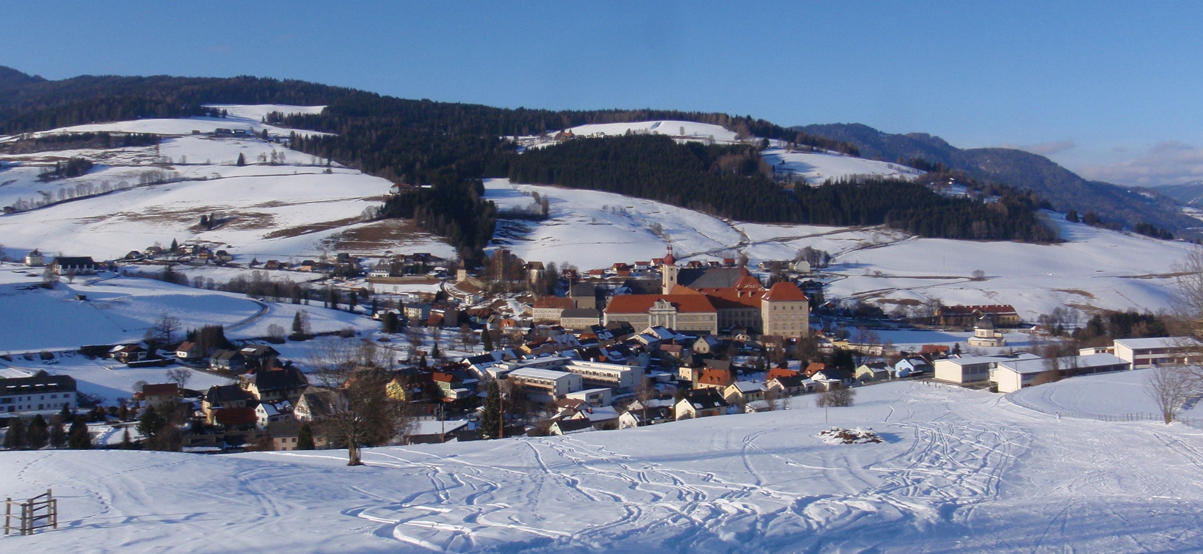
Map of Murau
Interactive Map
Murau Population
Years 1975 to 2020
| Data | 1975 | 1990 | 2000 | 2015 | 2020 |
|---|---|---|---|---|---|
| Population | 4,511 | 3,532 | 3,199 | 2,724 | 2,723 |
| Population Density | 2,187.2 / km² | 1,712.5 / km² | 1,551 / km² | 1,320.7 / km² | 1,320.2 / km² |
Sources: JRC (European Commission's Joint Research Centre) work on the GHS built-up grid
Murau Population change from 2000 to 2015
Decrease of 14.8% from year 2000 to 2015
| Location | Change since 1975 | Change since 1990 | Change since 2000 |
|---|---|---|---|
| Murau | -39.6% | -22.9% | -14.8% |
| Styria | +0.6% | +4.4% | +2.7% |
| Austria | +12.1% | +10.9% | +6.1% |
Sources: JRC (European Commission's Joint Research Centre) work on the GHS built-up grid
Murau Median Age
Median Age: 48.3 years
| Location | Median Age | Median Age (Female) | Median Age (Male) |
|---|---|---|---|
| Murau | 48.3 yrs | 50.5 yrs | 45.7 yrs |
| Styria | 43.2 yrs | 44.6 yrs | 41.8 yrs |
| Austria | 42.3 yrs | 43.5 yrs | 41.1 yrs |
Sources: CIESIN (Center for International Earth Science Information Network)
Murau Population Density
Population Density: 1,320 / km²
| Location | Population | Area | Density |
|---|---|---|---|
| Murau | 2,723 | 2.063 km² | 1,320 / km² |
| Styria | 1.2 million | 16,413 km² | 74.4 / km² |
| Austria | 8.5 million | 83,905.5 km² | 102 / km² |
Sources: JRC (European Commission's Joint Research Centre) work on the GHS built-up grid
Murau Historical and Projected Population
Estimated Population from 0 to 2100
Sources:
- JRC (European Commission's Joint Research Centre) work on the GHS built-up grid
- CIESIN (Center for International Earth Science Information Network)
- [Link] Klein Goldewijk, K., Beusen, A., Doelman, J., and Stehfest, E.: Anthropogenic land use estimates for the Holocene – HYDE 3.2, Earth Syst. Sci. Data, 9, 927–953, https://doi.org/10.5194/essd-9-927-2017, 2017.
Area Codes
Percentage Area Codes used by businesses in Murau
Price Distribution
Business distribution by price for Murau
Human Development Index (HDI)
Statistic composite index of life expectancy, education, and per capita income.
Source: [Link] Kummu, M., Taka, M. &Guillaume, J. Gridded global datasets for Gross Domestic Product and Human Development Index over 1990–2015. Sci Data 5, 180004 (2018) doi:10.1038/sdata.2018.4
Murau CO2 Emissions
Carbon Dioxide (CO2) Emissions Per Capita in Tonnes Per Year
| Location | CO2 Emissions | CO2 Emissions Per Capita | CO2 Emissions Intensity |
|---|---|---|---|
| Murau | 27,922 tn | 10.25 tn | 13,538.1 tons/km² |
| Styria | 12,758,818 tn | 10.45 tn | 777.4 tons/km² |
| Austria | 91,216,590 tn | 10.69 tn | 1,087.1 tons/km² |
Sources: [Link] Moran, D., Kanemoto K; Jiborn, M., Wood, R., Többen, J., and Seto, K.C. (2018) Carbon footprints of 13,000 cities. Environmental Research Letters DOI: 10.1088/1748-9326/aac72a
Murau CO2 Emissions
| 2013 CO2 emissions (tonnes/year) | 27,922 tn |
| 2013 CO2 emissions (tonnes/year) per capita | 10.25 tn |
| 2013 CO2 emissions intensity (tonnes/km²/year) | 13,538.1 tons/km² |
Natural Hazards Risk
Relative risk out of 10
| Hazard | Risk Level |
|---|---|
| Earthquake | Medium (4) |
* Risk, particularly concerning flood or landslide, may not be for the entire area.
Sources:
- Dilley, M., R.S. Chen, U. Deichmann, A.L. Lerner-Lam, M. Arnold, J. Agwe, P. Buys, O. Kjekstad, B. Lyon, and G. Yetman. 2005. Natural Disaster Hotspots: A Global Risk Analysis. Washington, D.C.: World Bank. https://doi.org/10.1596/0-8213-5930-4.
- Center for Hazards and Risk Research - CHRR - Columbia University, Center for International Earth Science Information Network - CIESIN - Columbia University. 2005. Global Earthquake Hazard Distribution - Peak Ground Acceleration. Palisades, NY: NASA Socioeconomic Data and Applications Center (SEDAC). https://doi.org/10.7927/H4BZ63ZS.
Recent Nearby Earthquakes
Magnitude 3.0 and greater
| Date▼ | Time↕ | Magnitude↕ | Distance↕ | Depth↕ | Location↕ | Link |
|---|---|---|---|---|---|---|
| 2/2/13 | 1:35 PM | 4 | 77.1 km | 10,000 m | Austria | usgs.gov |
| 12/29/08 | 4:10 AM | 3 | 29.2 km | 8,800 m | Austria | usgs.gov |
| 7/18/08 | 10:54 PM | 4.1 | 48.7 km | 10,000 m | Austria | usgs.gov |
| 6/22/08 | 3:05 PM | 3.2 | 83 km | 1,300 m | Austria | usgs.gov |
| 5/21/08 | 1:39 PM | 3.5 | 65.4 km | 1,400 m | Austria | usgs.gov |
| 3/19/08 | 4:50 AM | 3.3 | 64 km | 8,600 m | Austria | usgs.gov |
| 11/25/07 | 8:33 PM | 3.1 | 77.1 km | 3,500 m | Austria | usgs.gov |
| 7/20/07 | 6:47 AM | 3 | 32.4 km | 10,000 m | Austria | usgs.gov |
| 7/15/07 | 4:36 PM | 3.2 | 37.1 km | 10,000 m | Austria | usgs.gov |
| 5/2/07 | 12:49 PM | 3.7 | 74.7 km | 2,000 m | Austria | usgs.gov |
Source: U.S. Geological Survey (USGS)


About Our Data
The data on this page is estimated using a number of publicly available tools and resources. It is provided without warranty, and could contain inaccuracies. Use at your own risk.