Categories in Wolfurt
Gas StationBuilding Materials SupplierClothing storesAssociation or OrganizationClubPost OfficeShipping CompanyComputer ConsultantArchitectsConstruction of buildingsElectricianEngineerHome Repair ContractorHVAC ContractorKitchen and bath cabinets and remodelMechanical EngineerPainting and paint contractorsPlumbing installation and repairRoofing contractorEducationKindergartenGraphic DesignerPhotographerWebsite DesignerBakeriesCatererGrocery stores and supermarketsRestaurantsBanksInsurance AgencyDentistsBeauty salonsHair SalonMassageAdvertising AgencyBusiness Management ConsultantBusiness Support & OutsourcingBusiness to Business ServiceShoppingWholesale storeGymPlaygroundSports clubSports ComplexCustoms brokers and clearing agentsElectric Vehicle Charging StationFreight/commercial transportFreight forwardingTransportation logisticsTransportation Service
Showing 1-50 of 54
Industries
Business Distribution by Industry in Wolfurt
| Industry Description | Number of Establishments |
|---|---|
| Shopping | 43 |
| Corporate management | 41 |
| Construction of buildings | 40 |
| Health and medical | 35 |
| Buses and trains | 18 |
| Education | 17 |
| Restaurants | 17 |
| Beauty salons | 16 |
| Electronics stores | 16 |
| Other accommodation | 16 |
| Wholesale of machinery | 16 |
| Other membership organizations | 16 |
| Wholesale of construction supplies | 15 |
| Electrical installation | 14 |
Wolfurt Facts
| Area | 4.4 km² |
| Population | 6,065 |
| Male Population | 3,006 (49.6%) |
| Female Population | 3,059 (50.4%) |
| Population change (1975 to 2020) | -0.9% |
| Population change (2000 to 2020) | +1.4% |
| Median Age | 40.5 years (Male: 39.4, Female: 41.5) |
| Area Codes | 5574 |
| Local Time | |
| Timezone | Central European Summer Time |
| Lat & Lng | 47.46667, 9.75000 |
| Postal Codes | 6921, 6922 |
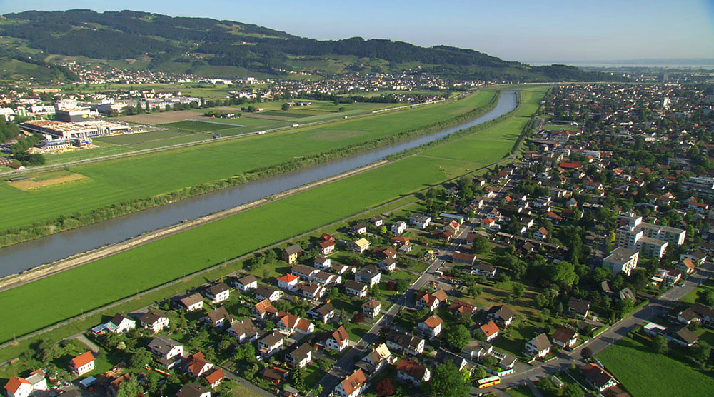
Map of Wolfurt
Interactive Map
Wolfurt Population
Years 1975 to 2020
| Data | 1975 | 1990 | 2000 | 2015 | 2020 |
|---|---|---|---|---|---|
| Population | 6,121 | 5,969 | 5,981 | 5,936 | 6,065 |
| Population Density | 1,379.4 / km² | 1,345.1 / km² | 1,347.8 / km² | 1,337.7 / km² | 1,366.8 / km² |
Sources: JRC (European Commission's Joint Research Centre) work on the GHS built-up grid
Wolfurt Population change from 2000 to 2015
Decrease of 0.8% from year 2000 to 2015
| Location | Change since 1975 | Change since 1990 | Change since 2000 |
|---|---|---|---|
| Wolfurt | -3% | -0.6% | -0.8% |
| Vorarlberg | +16.7% | +13.2% | +7.2% |
| Austria | +12.1% | +10.9% | +6.1% |
Sources: JRC (European Commission's Joint Research Centre) work on the GHS built-up grid
Wolfurt Median Age
Median Age: 40.5 years
| Location | Median Age | Median Age (Female) | Median Age (Male) |
|---|---|---|---|
| Wolfurt | 40.5 yrs | 41.5 yrs | 39.4 yrs |
| Vorarlberg | 40.4 yrs | 41.3 yrs | 39.4 yrs |
| Austria | 42.3 yrs | 43.5 yrs | 41.1 yrs |
Sources: CIESIN (Center for International Earth Science Information Network)
Wolfurt Population Density
Population Density: 1,367 / km²
| Location | Population | Area | Density |
|---|---|---|---|
| Wolfurt | 6,065 | 4.438 km² | 1,367 / km² |
| Vorarlberg | 379,637 | 2,591.5 km² | 147 / km² |
| Austria | 8.5 million | 83,905.5 km² | 102 / km² |
Sources: JRC (European Commission's Joint Research Centre) work on the GHS built-up grid
Wolfurt Historical and Projected Population
Estimated Population from 100 to 2100
Sources:
- JRC (European Commission's Joint Research Centre) work on the GHS built-up grid
- CIESIN (Center for International Earth Science Information Network)
- [Link] Klein Goldewijk, K., Beusen, A., Doelman, J., and Stehfest, E.: Anthropogenic land use estimates for the Holocene – HYDE 3.2, Earth Syst. Sci. Data, 9, 927–953, https://doi.org/10.5194/essd-9-927-2017, 2017.
Area Codes
Percentage Area Codes used by businesses in Wolfurt
Price Distribution
Business distribution by price for Wolfurt
Human Development Index (HDI)
Statistic composite index of life expectancy, education, and per capita income.
Source: [Link] Kummu, M., Taka, M. &Guillaume, J. Gridded global datasets for Gross Domestic Product and Human Development Index over 1990–2015. Sci Data 5, 180004 (2018) doi:10.1038/sdata.2018.4
Wolfurt CO2 Emissions
Carbon Dioxide (CO2) Emissions Per Capita in Tonnes Per Year
| Location | CO2 Emissions | CO2 Emissions Per Capita | CO2 Emissions Intensity |
|---|---|---|---|
| Wolfurt | 57,152 tn | 9.42 tn | 12,879.4 tons/km² |
| Vorarlberg | 3,558,171 tn | 9.37 tn | 1,373 tons/km² |
| Austria | 91,216,590 tn | 10.69 tn | 1,087.1 tons/km² |
Sources: [Link] Moran, D., Kanemoto K; Jiborn, M., Wood, R., Többen, J., and Seto, K.C. (2018) Carbon footprints of 13,000 cities. Environmental Research Letters DOI: 10.1088/1748-9326/aac72a
Wolfurt CO2 Emissions
| 2013 CO2 emissions (tonnes/year) | 57,152 tn |
| 2013 CO2 emissions (tonnes/year) per capita | 9.42 tn |
| 2013 CO2 emissions intensity (tonnes/km²/year) | 12,879.4 tons/km² |
Natural Hazards Risk
Relative risk out of 10
| Hazard | Risk Level |
|---|---|
| Flood | High (9) |
| Earthquake | Medium (4) |
| Landslide | Medium (6) |
* Risk, particularly concerning flood or landslide, may not be for the entire area.
Sources:
- Dilley, M., R.S. Chen, U. Deichmann, A.L. Lerner-Lam, M. Arnold, J. Agwe, P. Buys, O. Kjekstad, B. Lyon, and G. Yetman. 2005. Natural Disaster Hotspots: A Global Risk Analysis. Washington, D.C.: World Bank. https://doi.org/10.1596/0-8213-5930-4.
- Center for Hazards and Risk Research - CHRR - Columbia University, Center for International Earth Science Information Network - CIESIN - Columbia University, and Norwegian Geotechnical Institute - NGI. 2005. Global Landslide Hazard Distribution. Palisades, NY: NASA Socioeconomic Data and Applications Center (SEDAC). https://doi.org/10.7927/H4P848VZ.
- Center for Hazards and Risk Research - CHRR - Columbia University, Center for International Earth Science Information Network - CIESIN - Columbia University. 2005. Global Flood Hazard Frequency and Distribution. Palisades, NY: NASA Socioeconomic Data and Applications Center (SEDAC). https://doi.org/10.7927/H4668B3D.
- Center for Hazards and Risk Research - CHRR - Columbia University, Center for International Earth Science Information Network - CIESIN - Columbia University. 2005. Global Earthquake Hazard Distribution - Peak Ground Acceleration. Palisades, NY: NASA Socioeconomic Data and Applications Center (SEDAC). https://doi.org/10.7927/H4BZ63ZS.
Recent Nearby Earthquakes
Magnitude 3.0 and greater
| Date▼ | Time↕ | Magnitude↕ | Distance↕ | Depth↕ | Location↕ | Link |
|---|---|---|---|---|---|---|
| 2/1/18 | 1:47 AM | 3.8 | 33.4 km | 5,000 m | 4km N of Innerbraz, Austria | usgs.gov |
| 1/17/18 | 7:07 PM | 4 | 35.9 km | 10,000 m | 2km NE of Innerbraz, Austria | usgs.gov |
| 12/12/13 | 12:59 AM | 3.6 | 49.7 km | 2,600 m | 1km SSW of Balzers, Liechtenstein | usgs.gov |
| 7/20/13 | 3:30 AM | 3.6 | 32.8 km | 4,200 m | 3km ESE of Andwil, Switzerland | usgs.gov |
| 1/4/09 | 3:30 PM | 4.5 | 43.8 km | 2,900 m | Switzerland | usgs.gov |
| 12/25/08 | 7:21 PM | 3.1 | 67.7 km | 10,000 m | Germany | usgs.gov |
| 12/16/08 | 12:34 AM | 3.1 | 41.7 km | 7,000 m | Switzerland | usgs.gov |
| 8/5/07 | 11:15 AM | 3.1 | 45.2 km | 0 m | Austria | usgs.gov |
| 5/27/05 | 5:22 PM | 3.6 | 55.2 km | 8,000 m | Switzerland | usgs.gov |
| 4/18/04 | 3:21 AM | 3.1 | 15.5 km | 33,000 m | Germany | usgs.gov |
Source: U.S. Geological Survey (USGS)


About Our Data
The data on this page is estimated using a number of publicly available tools and resources. It is provided without warranty, and could contain inaccuracies. Use at your own risk.