Categories in Landerneau
Industries
Business Distribution by Industry in Landerneau
| Industry Description | Number of Establishments | Average Age of Business |
|---|---|---|
| Restaurants | 71 | 16 years |
| Health and medical | 70 | — |
| Corporate management | 54 | 16 years |
| Shopping | 52 | 21 years |
| Public administration | 35 | — |
| Clothing stores | 35 | — |
| Real estate | 34 | 35 years |
| Shopping other | 33 | 22 years |
| Nurses | 32 | — |
| Car repair | 30 | 54 years |
| Education | 28 | — |
| Hairdressers | 25 | — |
| Banks | 24 | — |
| Dentists | 24 | — |
| Construction of buildings | 21 | — |
| Grocery stores and supermarkets | 21 | 42 years |
| Other membership organizations | 21 | — |
Landerneau Facts
| Area | 13.8 km² |
| Population | 16,175 |
| Male Population | 7,777 (48.1%) |
| Female Population | 8,398 (51.9%) |
| Population change (1975 to 2020) | +31.0% |
| Population change (2000 to 2020) | +12.2% |
| Median Age | 38.7 years (Male: 35.7, Female: 42.2) |
| Neighborhoods | Europe, Brest Centre, Saint-Martin, Saint-Pierre |
| Local Time | |
| Timezone | Central European Summer Time |
| Lat & Lng | 48.45252, -4.25252 |
| Postal Codes | 29206 CEDEX, 29207 CEDEX, 29208 CEDEX, 29209 CEDEX, 29411 CEDEX, More |
Map of Landerneau
Interactive Map
Landerneau Population
Years 1975 to 2020
| Data | 1975 | 1990 | 2000 | 2015 | 2020 |
|---|---|---|---|---|---|
| Population | 12,346 | 13,704 | 14,421 | 15,633 | 16,175 |
| Population Density | 893.8 / km² | 992.1 / km² | 1,044.1 / km² | 1,131.8 / km² | 1,171 / km² |
Landerneau Population change from 2000 to 2015
Increase of 8.4% from year 2000 to 2015
| Location | Change since 1975 | Change since 1990 | Change since 2000 |
|---|---|---|---|
| Landerneau | +26.6% | +14.1% | +8.4% |
| France | +22.7% | +13.8% | +8.8% |
Landerneau Median Age
Median Age: 38.7 years
| Location | Median Age | Median Age (Female) | Median Age (Male) |
|---|---|---|---|
| Landerneau | 38.7 yrs | 42.2 yrs | 35.7 yrs |
| France | 39.6 yrs | 41 yrs | 38.1 yrs |
Landerneau Population Density
Population Density: 1,171 / km²
| Location | Population | Area | Density |
|---|---|---|---|
| Landerneau | 16,175 | 13.8 km² | 1,171 / km² |
| France | 65.9 million | 638,022.5 km² | 103 / km² |
Landerneau Historical and Projected Population
Estimated Population from 0 to 2100
- JRC (European Commission's Joint Research Centre) work on the GHS built-up grid
- CIESIN (Center for International Earth Science Information Network)
- [Link] Klein Goldewijk, K., Beusen, A., Doelman, J., and Stehfest, E.: Anthropogenic land use estimates for the Holocene – HYDE 3.2, Earth Syst. Sci. Data, 9, 927–953, https://doi.org/10.5194/essd-9-927-2017, 2017.
Area Codes
Percentage Area Codes used by businesses in Landerneau
Price Distribution
Business distribution by price for Landerneau
Human Development Index (HDI)
Statistic composite index of life expectancy, education, and per capita income.
Landerneau CO2 Emissions
Carbon Dioxide (CO2) Emissions Per Capita in Tonnes Per Year
| Location | CO2 Emissions | CO2 Emissions Per Capita | CO2 Emissions Intensity |
|---|---|---|---|
| Landerneau | 119,174 tn | 7.37 tn | 8,628 tons/km² |
| France | 485,797,691 tn | 7.38 tn | 761.4 tons/km² |
| 2013 CO2 emissions (tonnes/year) | 119,174 tn |
| 2013 CO2 emissions (tonnes/year) per capita | 7.37 tn |
| 2013 CO2 emissions intensity (tonnes/km²/year) | 8,628 tons/km² |
Natural Hazards Risk
Relative risk out of 10
| Hazard | Risk Level |
|---|---|
| Drought | Low (2) |
| Earthquake | Low (2) |
| Cyclone | Medium (5) |
* Risk, particularly concerning flood or landslide, may not be for the entire area.
- Dilley, M., R.S. Chen, U. Deichmann, A.L. Lerner-Lam, M. Arnold, J. Agwe, P. Buys, O. Kjekstad, B. Lyon, and G. Yetman. 2005. Natural Disaster Hotspots: A Global Risk Analysis. Washington, D.C.: World Bank. https://doi.org/10.1596/0-8213-5930-4.
- Center for Hazards and Risk Research - CHRR - Columbia University, Center for International Earth Science Information Network - CIESIN - Columbia University, International Bank for Reconstruction and Development - The World Bank, and United Nations Environment Programme Global Resource Information Database Geneva - UNEP/GRID-Geneva. 2005. Global Cyclone Hazard Frequency and Distribution. Palisades, NY: NASA Socioeconomic Data and Applications Center (SEDAC). https://doi.org/10.7927/H4CZ353K.
- Center for Hazards and Risk Research - CHRR - Columbia University, Center for International Earth Science Information Network - CIESIN - Columbia University, and International Research Institute for Climate and Society - IRI - Columbia University. 2005. Global Drought Hazard Frequency and Distribution. Palisades, NY: NASA Socioeconomic Data and Applications Center (SEDAC). https://doi.org/10.7927/H4VX0DFT.
- Center for Hazards and Risk Research - CHRR - Columbia University, Center for International Earth Science Information Network - CIESIN - Columbia University. 2005. Global Earthquake Hazard Distribution - Peak Ground Acceleration. Palisades, NY: NASA Socioeconomic Data and Applications Center (SEDAC). https://doi.org/10.7927/H4BZ63ZS.
Recent Nearby Earthquakes
Magnitude 3.0 and greater
| Date▼ | Time↕ | Magnitude↕ | Distance↕ | Depth↕ | Location↕ | Link |
|---|---|---|---|---|---|---|
| 12/11/16 | 9:27 PM | 3.9 | 15.9 km | 2,000 m | 2km WSW of Plabennec, France | usgs.gov |
| 12/11/13 | 10:49 PM | 3.5 | 20.6 km | 2,000 m | 6km S of Hopital-Camfrout, France | usgs.gov |
| 8/23/08 | 8:57 AM | 3.2 | 64.4 km | 10,600 m | France | usgs.gov |
| 10/8/07 | 3:50 AM | 3.5 | 62.3 km | 11,300 m | France | usgs.gov |
| 7/20/07 | 9:38 AM | 3 | 66.5 km | 15,500 m | North Atlantic Ocean | usgs.gov |
| 10/30/06 | 12:39 AM | 3.1 | 28.9 km | 20,000 m | France | usgs.gov |
| 8/28/06 | 6:26 PM | 3.4 | 75.4 km | 2,000 m | North Atlantic Ocean | usgs.gov |
| 7/13/06 | 12:23 PM | 3.1 | 34.4 km | 13,000 m | France | usgs.gov |
| 3/10/05 | 10:21 AM | 3.1 | 90 km | 9,700 m | France | usgs.gov |
| 2/9/05 | 9:13 AM | 3.4 | 89.1 km | 10,000 m | France | usgs.gov |
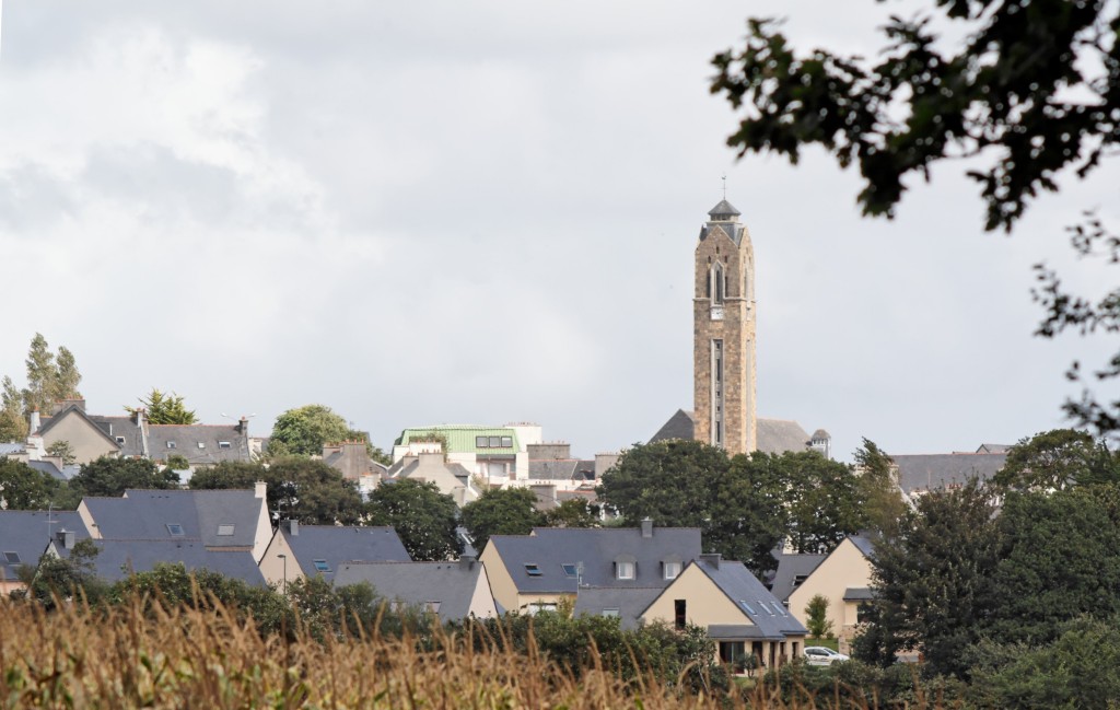
Landerneau
Landerneau (Landerne in Breton) is a commune in the Finistère department of Brittany in north-western France. lies at the mouth of the Elorn River which divides the Breton provinces of Cornouaille and Léon, 20 km (12 mi) east of Brest. The name mean..
Landerneau Wikipedia Page


About Our Data
The data on this page is estimated using a number of publicly available tools and resources. It is provided without warranty, and could contain inaccuracies. Use at your own risk.