Categories in Amaliada
Industries
Business Distribution by Industry in Amaliada
| Industry Description | Number of Establishments |
|---|---|
| Cafes | 77 |
| Shopping | 74 |
| Restaurants | 61 |
| Churches | 57 |
| Grocery stores and supermarkets | 50 |
| Gas station | 49 |
| Other accommodation | 37 |
| Education | 36 |
| Car repair | 27 |
| Corporate management | 26 |
| Religion | 25 |
| Pharmacies and drug stores | 24 |
| Bakeries | 23 |
| All food and beverage | 23 |
Amaliada Facts
| Area | 10.2 km² |
| Population | 14,161 |
| Male Population | 7,158 (50.5%) |
| Female Population | 7,003 (49.5%) |
| Population change (1975 to 2020) | -12.8% |
| Population change (2000 to 2020) | -9.8% |
| Median Age | 42.1 years (Male: 41.2, Female: 43) |
| Area Codes | 2622 |
| Local Time | |
| Timezone | Eastern European Summer Time |
| Lat & Lng | 37.79842, 21.35068 |
| Postal Codes | 272 00 |
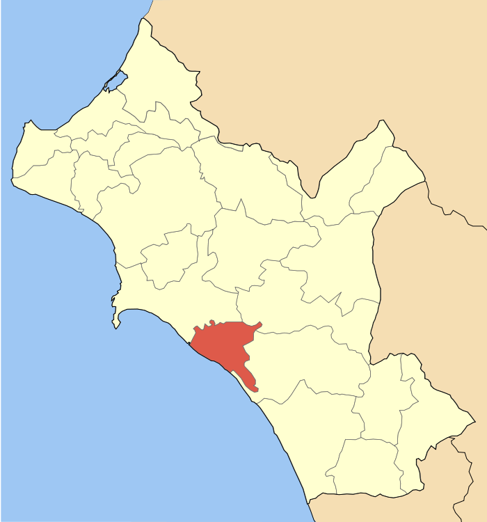
Map of Amaliada
Interactive Map
Amaliada Population
Years 1975 to 2020
| Data | 1975 | 1990 | 2000 | 2015 | 2020 |
|---|---|---|---|---|---|
| Population | 16,240 | 16,438 | 15,702 | 13,833 | 14,161 |
| Population Density | 1,594.1 / km² | 1,613.5 / km² | 1,541.3 / km² | 1,357.8 / km² | 1,390 / km² |
Amaliada Population change from 2000 to 2015
Decrease of 11.9% from year 2000 to 2015
| Location | Change since 1975 | Change since 1990 | Change since 2000 |
|---|---|---|---|
| Amaliada | -14.8% | -15.8% | -11.9% |
| Greece | +21.3% | +8.1% | +0% |
Amaliada Median Age
Median Age: 42.1 years
| Location | Median Age | Median Age (Female) | Median Age (Male) |
|---|---|---|---|
| Amaliada | 42.1 yrs | 43 yrs | 41.2 yrs |
| Greece | 41.8 yrs | 43.1 yrs | 40.5 yrs |
Amaliada Population Density
Population Density: 1,390 / km²
| Location | Population | Area | Density |
|---|---|---|---|
| Amaliada | 14,161 | 10.2 km² | 1,390 / km² |
| Greece | 10.7 million | 132,689.5 km² | 80.4 / km² |
Amaliada Historical and Projected Population
Estimated Population from 0 to 2100
- JRC (European Commission's Joint Research Centre) work on the GHS built-up grid
- CIESIN (Center for International Earth Science Information Network)
- [Link] Klein Goldewijk, K., Beusen, A., Doelman, J., and Stehfest, E.: Anthropogenic land use estimates for the Holocene – HYDE 3.2, Earth Syst. Sci. Data, 9, 927–953, https://doi.org/10.5194/essd-9-927-2017, 2017.
Price Distribution
Business distribution by price for Amaliada
Human Development Index (HDI)
Statistic composite index of life expectancy, education, and per capita income.
Amaliada CO2 Emissions
Carbon Dioxide (CO2) Emissions Per Capita in Tonnes Per Year
| Location | CO2 Emissions | CO2 Emissions Per Capita | CO2 Emissions Intensity |
|---|---|---|---|
| Amaliada | 119,057 tn | 8.41 tn | 11,686.6 tons/km² |
| Greece | 105,407,278 tn | 9.89 tn | 794.4 tons/km² |
| 2013 CO2 emissions (tonnes/year) | 119,057 tn |
| 2013 CO2 emissions (tonnes/year) per capita | 8.41 tn |
| 2013 CO2 emissions intensity (tonnes/km²/year) | 11,686.6 tons/km² |
Natural Hazards Risk
Relative risk out of 10
| Hazard | Risk Level |
|---|---|
| Drought | High (8) |
| Earthquake | Medium (7) |
* Risk, particularly concerning flood or landslide, may not be for the entire area.
- Dilley, M., R.S. Chen, U. Deichmann, A.L. Lerner-Lam, M. Arnold, J. Agwe, P. Buys, O. Kjekstad, B. Lyon, and G. Yetman. 2005. Natural Disaster Hotspots: A Global Risk Analysis. Washington, D.C.: World Bank. https://doi.org/10.1596/0-8213-5930-4.
- Center for Hazards and Risk Research - CHRR - Columbia University, Center for International Earth Science Information Network - CIESIN - Columbia University, and International Research Institute for Climate and Society - IRI - Columbia University. 2005. Global Drought Hazard Frequency and Distribution. Palisades, NY: NASA Socioeconomic Data and Applications Center (SEDAC). https://doi.org/10.7927/H4VX0DFT.
- Center for Hazards and Risk Research - CHRR - Columbia University, Center for International Earth Science Information Network - CIESIN - Columbia University. 2005. Global Earthquake Hazard Distribution - Peak Ground Acceleration. Palisades, NY: NASA Socioeconomic Data and Applications Center (SEDAC). https://doi.org/10.7927/H4BZ63ZS.
Recent Nearby Earthquakes
Magnitude 3.0 and greater
| Date▼ | Time↕ | Magnitude↕ | Distance↕ | Depth↕ | Location↕ | Link |
|---|---|---|---|---|---|---|
| 5/15/19 | 10:26 PM | 4.1 | 8.9 km | 10,000 m | 5km SW of Savalia, Greece | usgs.gov |
| 5/15/19 | 12:02 AM | 4.3 | 8.6 km | 10,000 m | 1km SE of Kavasilas, Greece | usgs.gov |
| 8/30/15 | 1:28 PM | 4.6 | 7.3 km | 31,760 m | 5km SSW of Savalia, Greece | usgs.gov |
| 4/18/15 | 1:36 PM | 4.3 | 6.3 km | 28,000 m | 1km WNW of Sinoikismos Khavarion, Greece | usgs.gov |
| 11/18/14 | 4:43 PM | 4.3 | 7.4 km | 10,000 m | 3km S of Kardamas, Greece | usgs.gov |
| 11/3/13 | 10:22 AM | 4.3 | 7.1 km | 20,700 m | 4km SSW of Savalia, Greece | usgs.gov |
| 10/23/13 | 3:38 PM | 4.5 | 9.8 km | 17,710 m | 6km S of Kardamas, Greece | usgs.gov |
| 10/3/08 | 12:45 PM | 3.7 | 7.3 km | 100 m | southern Greece | usgs.gov |
| 9/2/08 | 12:10 AM | 3.2 | 6.6 km | 18,000 m | southern Greece | usgs.gov |
| 8/28/08 | 10:28 PM | 3.2 | 10.5 km | 18,000 m | southern Greece | usgs.gov |
Amaliada
Amaliada (Greek: Αμαλιάδα, Katharevousa: Ἀμαλιάς, Amalias) is a town and a former municipality in northwestern Elis, West Greece, Greece. Since the 2011 local government reform it is part of the municipality Ilida, of which it is the seat and a munic..
Amaliada Wikipedia Page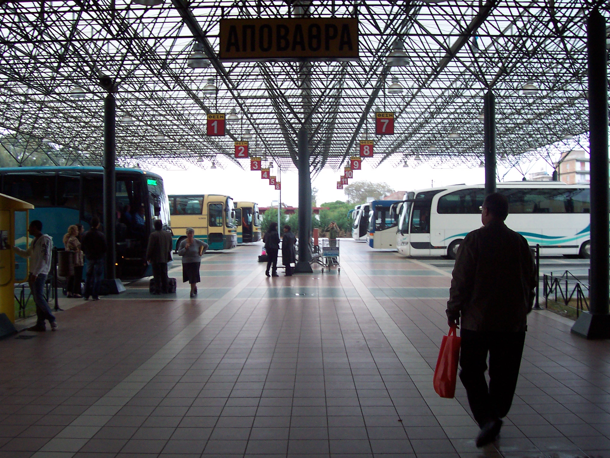
About Our Data
The data on this page is estimated using a number of publicly available tools and resources. It is provided without warranty, and could contain inaccuracies. Use at your own risk.