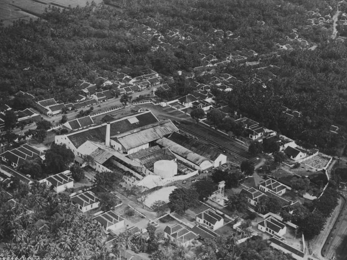
Categories in Kroya
Car rentalCar repairCar Repair and MaintenanceMotorcycle repairClothing storesLaundry ServiceMobile phone storesGeneral Religious Organizations & PlacesMosquesReligionShipping ServiceElectronics StoreHousing DevelopmentEducationEducational InstitutionEducation CenterElementary SchoolAsian RestaurantBakso restaurantCafesCoffee ShopDelisDinerGrocery stores and supermarketsNoodle ShopRestaurantsSoup ShopAtm'sBanksFinancial InstitutionBarbersBeauty salonsBusiness to Business ServiceHousing ComplexConvenience storesDepartment storesShoppingShopping MallShopping otherSupermarketTravel Agency
Industries
Business Distribution by Industry in Kroya
| Industry Description | Number of Establishments |
|---|---|
| Shopping | 40 |
| Religion | 33 |
| Restaurants | 29 |
| Education | 25 |
| Cafes | 15 |
| Electronics stores | 13 |
| Grocery stores and supermarkets | 12 |
| Mosques | 11 |
| All food and beverage | 11 |
| Clothing stores | 11 |
| Banks | 10 |
| Car repair | 9 |
| Other accommodation | 8 |
| Atm's | 7 |
| Finance other | 7 |
| Beauty salons | 6 |
| Mobile phone stores | 6 |
| Hardware store | 6 |
| Travel and transportation | 6 |
Kroya Facts
| Area | 23.2 km² |
| Population | 63,386 |
| Male Population | 31,817 (50.2%) |
| Female Population | 31,569 (49.8%) |
| Population change (1975 to 2020) | +80.7% |
| Population change (2000 to 2020) | -3.4% |
| Median Age | 30.2 years (Male: 29.5, Female: 31) |
| Area Codes | 28 |
| Neighborhoods | Kroya, Semingkir, Kedawung, Kroya, Banjar, Kroya, Mujur, Banyumas, Dongkelan, Kroya |
| Local Time | |
| Timezone | Western Indonesia Time |
| Lat & Lng | -7.63306, 109.24611 |
| Postal Codes | 53282 |
Map of Kroya
Interactive Map
Kroya Population
Years 1975 to 2020
| Data | 1975 | 1990 | 2000 | 2015 | 2020 |
|---|---|---|---|---|---|
| Population | 35,084 | 68,885 | 65,596 | 60,990 | 63,386 |
| Population Density | 1,513.1 / km² | 2,970.8 / km² | 2,828.9 / km² | 2,630.3 / km² | 2,733.6 / km² |
Sources: JRC (European Commission's Joint Research Centre) work on the GHS built-up grid
Kroya Population change from 2000 to 2015
Decrease of 7% from year 2000 to 2015
| Location | Change since 1975 | Change since 1990 | Change since 2000 |
|---|---|---|---|
| Kroya | +73.8% | -11.5% | -7% |
| Central Java | +763.3% | +4% | +2% |
| Indonesia | +96.9% | +41.9% | +21.7% |
Sources: JRC (European Commission's Joint Research Centre) work on the GHS built-up grid
Kroya Median Age
Median Age: 30.2 years
| Location | Median Age | Median Age (Female) | Median Age (Male) |
|---|---|---|---|
| Kroya | 30.2 yrs | 31 yrs | 29.5 yrs |
| Central Java | 30.5 yrs | 31.2 yrs | 29.8 yrs |
| Indonesia | 27.2 yrs | 27.5 yrs | 26.9 yrs |
Sources: CIESIN (Center for International Earth Science Information Network)
Kroya Population Density
Population Density: 2,734 / km²
| Location | Population | Area | Density |
|---|---|---|---|
| Kroya | 63,386 | 23.2 km² | 2,734 / km² |
| Central Java | 10,593 | 23.8 km² | 445 / km² |
| Indonesia | 252.8 million | 1,893,657.8 km² | 134 / km² |
Sources: JRC (European Commission's Joint Research Centre) work on the GHS built-up grid
Kroya Historical and Projected Population
Estimated Population from 1700 to 2100
Sources:
- JRC (European Commission's Joint Research Centre) work on the GHS built-up grid
- CIESIN (Center for International Earth Science Information Network)
- [Link] Klein Goldewijk, K., Beusen, A., Doelman, J., and Stehfest, E.: Anthropogenic land use estimates for the Holocene – HYDE 3.2, Earth Syst. Sci. Data, 9, 927–953, https://doi.org/10.5194/essd-9-927-2017, 2017.
Neighborhoods in Kroya
Percentage of businesses by neighborhood in Kroya
Price Distribution
Business distribution by price for Kroya
Human Development Index (HDI)
Statistic composite index of life expectancy, education, and per capita income.
Source: [Link] Kummu, M., Taka, M. &Guillaume, J. Gridded global datasets for Gross Domestic Product and Human Development Index over 1990–2015. Sci Data 5, 180004 (2018) doi:10.1038/sdata.2018.4
Kroya CO2 Emissions
Carbon Dioxide (CO2) Emissions Per Capita in Tonnes Per Year
| Location | CO2 Emissions | CO2 Emissions Per Capita | CO2 Emissions Intensity |
|---|---|---|---|
| Kroya | 125,284 tn | 1.98 tn | 5,403.1 tons/km² |
| Central Java | 12,008 tn | 1.13 tn | 503.9 tons/km² |
| Indonesia | 478,610,416 tn | 1.89 tn | 252.7 tons/km² |
Sources: [Link] Moran, D., Kanemoto K; Jiborn, M., Wood, R., Többen, J., and Seto, K.C. (2018) Carbon footprints of 13,000 cities. Environmental Research Letters DOI: 10.1088/1748-9326/aac72a
Kroya CO2 Emissions
| 2013 CO2 emissions (tonnes/year) | 125,284 tn |
| 2013 CO2 emissions (tonnes/year) per capita | 1.98 tn |
| 2013 CO2 emissions intensity (tonnes/km²/year) | 5,403.1 tons/km² |
Natural Hazards Risk
Relative risk out of 10
| Hazard | Risk Level |
|---|---|
| Drought | Medium (5) |
| Flood | High (10) |
| Earthquake | Medium (7) |
* Risk, particularly concerning flood or landslide, may not be for the entire area.
Sources:
- Dilley, M., R.S. Chen, U. Deichmann, A.L. Lerner-Lam, M. Arnold, J. Agwe, P. Buys, O. Kjekstad, B. Lyon, and G. Yetman. 2005. Natural Disaster Hotspots: A Global Risk Analysis. Washington, D.C.: World Bank. https://doi.org/10.1596/0-8213-5930-4.
- Center for Hazards and Risk Research - CHRR - Columbia University, Center for International Earth Science Information Network - CIESIN - Columbia University, and International Research Institute for Climate and Society - IRI - Columbia University. 2005. Global Drought Hazard Frequency and Distribution. Palisades, NY: NASA Socioeconomic Data and Applications Center (SEDAC). https://doi.org/10.7927/H4VX0DFT.
- Center for Hazards and Risk Research - CHRR - Columbia University, Center for International Earth Science Information Network - CIESIN - Columbia University. 2005. Global Flood Hazard Frequency and Distribution. Palisades, NY: NASA Socioeconomic Data and Applications Center (SEDAC). https://doi.org/10.7927/H4668B3D.
- Center for Hazards and Risk Research - CHRR - Columbia University, Center for International Earth Science Information Network - CIESIN - Columbia University. 2005. Global Earthquake Hazard Distribution - Peak Ground Acceleration. Palisades, NY: NASA Socioeconomic Data and Applications Center (SEDAC). https://doi.org/10.7927/H4BZ63ZS.
Recent Nearby Earthquakes
Magnitude 3.0 and greater
| Date▼ | Time↕ | Magnitude↕ | Distance↕ | Depth↕ | Location↕ | Link |
|---|---|---|---|---|---|---|
| 6/29/19 | 6:47 AM | 5.1 | 69.3 km | 78,890 m | 54km S of Karangbadar Kidul, Indonesia | usgs.gov |
| 6/9/19 | 9:32 AM | 5.2 | 72.8 km | 80,390 m | 58km S of Karangbadar Kidul, Indonesia | usgs.gov |
| 1/7/19 | 4:58 PM | 4.5 | 72.3 km | 71,480 m | 56km SSW of Karangbadar Kidul, Indonesia | usgs.gov |
| 4/18/18 | 6:28 AM | 4.5 | 62 km | 10,000 m | 24km SSE of Buaran, Indonesia | usgs.gov |
| 11/9/17 | 4:57 PM | 4.2 | 72.3 km | 124,750 m | 1km ENE of Cipari, Indonesia | usgs.gov |
| 10/26/17 | 2:18 AM | 4.1 | 56.7 km | 94,360 m | 14km S of Mekarsari, Indonesia | usgs.gov |
| 9/23/17 | 5:07 AM | 4.4 | 75.9 km | 65,250 m | 60km S of Karangbadar Kidul, Indonesia | usgs.gov |
| 8/3/17 | 4:14 PM | 5 | 64.9 km | 63,180 m | 50km S of Karangbadar Kidul, Indonesia | usgs.gov |
| 11/15/16 | 12:41 PM | 4.2 | 49.8 km | 102,730 m | 49km SSE of Kroya, Indonesia | usgs.gov |
| 8/16/16 | 4:21 PM | 4.7 | 69.8 km | 82,630 m | 69km S of Kroya, Indonesia | usgs.gov |
Source: U.S. Geological Survey (USGS)


About Our Data
The data on this page is estimated using a number of publicly available tools and resources. It is provided without warranty, and could contain inaccuracies. Use at your own risk.