Categories in Solok
Industries
Business Distribution by Industry in Solok
| Industry Description | Number of Establishments |
|---|---|
| Religion | 2,038 |
| Shopping | 1,523 |
| Education | 993 |
| Restaurants | 808 |
| Cafes | 706 |
| Mosques | 580 |
| Clothing stores | 467 |
| Grocery stores and supermarkets | 399 |
| Corporate management | 336 |
| Electronics stores | 274 |
| Public administration | 247 |
| Car repair | 237 |
Solok Facts
| Area | 225.7 km² |
| Population | 221,748 |
| Male Population | 109,455 (49.4%) |
| Female Population | 112,293 (50.6%) |
| Population change (1975 to 2020) | +66.2% |
| Population change (2000 to 2020) | +14.2% |
| Median Age | 25.2 years (Male: 24.7, Female: 25.8) |
| Area Codes | 75 |
| Neighborhoods | Pasar Pandan Air Mati, Tanjung Harapan, Kampai Tabu Karambia, Lubuk Sikarah, Simpang Rumbio, Lubuk Sikarah, Koto Baru, Kubung, Ix Korong, Lubuk Sikarah |
| Local Time | |
| Timezone | Western Indonesia Time |
| Lat & Lng | -0.80060, 100.65710 |
| Postal Codes | 27311, 27312, 27313, 27314, 27315, More |
Map of Solok
Interactive Map
Solok Population
Years 1975 to 2020
| Data | 1975 | 1990 | 2000 | 2015 | 2020 |
|---|---|---|---|---|---|
| Population | 133,448 | 189,479 | 194,114 | 213,718 | 221,748 |
| Population Density | 591.3 / km² | 839.6 / km² | 860.1 / km² | 947 / km² | 982.5 / km² |
Solok Population change from 2000 to 2015
Increase of 10.1% from year 2000 to 2015
| Location | Change since 1975 | Change since 1990 | Change since 2000 |
|---|---|---|---|
| Solok | +60.2% | +12.8% | +10.1% |
| West Sumatra | +41.3% | +6.7% | +3.3% |
| Indonesia | +96.9% | +41.9% | +21.7% |
Solok Median Age
Median Age: 25.2 years
| Location | Median Age | Median Age (Female) | Median Age (Male) |
|---|---|---|---|
| Solok | 25.2 yrs | 25.8 yrs | 24.7 yrs |
| West Sumatra | 26.8 yrs | 28.2 yrs | 25.4 yrs |
| Indonesia | 27.2 yrs | 27.5 yrs | 26.9 yrs |
Solok Population Density
Population Density: 983 / km²
| Location | Population | Area | Density |
|---|---|---|---|
| Solok | 221,748 | 225.7 km² | 983 / km² |
| West Sumatra | 21,004 | 50.2 km² | 419 / km² |
| Indonesia | 252.8 million | 1,893,657.8 km² | 134 / km² |
Solok Historical and Projected Population
Estimated Population from 1300 to 2100
- JRC (European Commission's Joint Research Centre) work on the GHS built-up grid
- CIESIN (Center for International Earth Science Information Network)
- [Link] Klein Goldewijk, K., Beusen, A., Doelman, J., and Stehfest, E.: Anthropogenic land use estimates for the Holocene – HYDE 3.2, Earth Syst. Sci. Data, 9, 927–953, https://doi.org/10.5194/essd-9-927-2017, 2017.
Neighborhoods in Solok
Percentage of businesses by neighborhood in Solok
Area Codes
Percentage Area Codes used by businesses in Solok
Postal Codes
Percentage of businesses by Postal Codes in Solok
Price Distribution
Business distribution by price for Solok
Human Development Index (HDI)
Statistic composite index of life expectancy, education, and per capita income.
Solok CO2 Emissions
Carbon Dioxide (CO2) Emissions Per Capita in Tonnes Per Year
| Location | CO2 Emissions | CO2 Emissions Per Capita | CO2 Emissions Intensity |
|---|---|---|---|
| Solok | 468,230 tn | 2.11 tn | 2,074.7 tons/km² |
| West Sumatra | 39,808 tn | 1.9 tn | 793.7 tons/km² |
| Indonesia | 478,610,416 tn | 1.89 tn | 252.7 tons/km² |
| 2013 CO2 emissions (tonnes/year) | 468,230 tn |
| 2013 CO2 emissions (tonnes/year) per capita | 2.11 tn |
| 2013 CO2 emissions intensity (tonnes/km²/year) | 2,074.7 tons/km² |
Natural Hazards Risk
Relative risk out of 10
| Hazard | Risk Level |
|---|---|
| Drought | Low (2) |
| Flood | Medium (7) |
| Earthquake | Medium (7) |
| Landslide | High (9) |
| Volcano | Medium (5) |
* Risk, particularly concerning flood or landslide, may not be for the entire area.
- Dilley, M., R.S. Chen, U. Deichmann, A.L. Lerner-Lam, M. Arnold, J. Agwe, P. Buys, O. Kjekstad, B. Lyon, and G. Yetman. 2005. Natural Disaster Hotspots: A Global Risk Analysis. Washington, D.C.: World Bank. https://doi.org/10.1596/0-8213-5930-4.
- Center for Hazards and Risk Research - CHRR - Columbia University, Center for International Earth Science Information Network - CIESIN - Columbia University, and Norwegian Geotechnical Institute - NGI. 2005. Global Landslide Hazard Distribution. Palisades, NY: NASA Socioeconomic Data and Applications Center (SEDAC). https://doi.org/10.7927/H4P848VZ.
- Center for Hazards and Risk Research - CHRR - Columbia University, Center for International Earth Science Information Network - CIESIN - Columbia University, and International Research Institute for Climate and Society - IRI - Columbia University. 2005. Global Drought Hazard Frequency and Distribution. Palisades, NY: NASA Socioeconomic Data and Applications Center (SEDAC). https://doi.org/10.7927/H4VX0DFT.
- Center for Hazards and Risk Research - CHRR - Columbia University, Center for International Earth Science Information Network - CIESIN - Columbia University. 2005. Global Flood Hazard Frequency and Distribution. Palisades, NY: NASA Socioeconomic Data and Applications Center (SEDAC). https://doi.org/10.7927/H4668B3D.
- Center for Hazards and Risk Research - CHRR - Columbia University, Center for International Earth Science Information Network - CIESIN - Columbia University. 2005. Global Volcano Hazard Frequency and Distribution. Palisades, NY: NASA Socioeconomic Data and Applications Center (SEDAC). https://doi.org/10.7927/H4BR8Q45.
- Center for Hazards and Risk Research - CHRR - Columbia University, Center for International Earth Science Information Network - CIESIN - Columbia University. 2005. Global Earthquake Hazard Distribution - Peak Ground Acceleration. Palisades, NY: NASA Socioeconomic Data and Applications Center (SEDAC). https://doi.org/10.7927/H4BZ63ZS.
Recent Nearby Earthquakes
Magnitude 3.0 and greater
| Date▼ | Time↕ | Magnitude↕ | Distance↕ | Depth↕ | Location↕ | Link |
|---|---|---|---|---|---|---|
| 7/24/19 | 3:01 PM | 4 | 47.3 km | 100,640 m | 11km SSW of Lubukalung, Indonesia | usgs.gov |
| 6/4/19 | 7:18 AM | 4.6 | 44.3 km | 96,990 m | 10km WNW of Tabing, Indonesia | usgs.gov |
| 3/19/19 | 6:17 PM | 4.3 | 55.8 km | 61,430 m | 4km ESE of Kotatua, Indonesia | usgs.gov |
| 2/4/19 | 6:57 AM | 4.8 | 35.4 km | 97,450 m | 13km WSW of Alahanpanjang, Indonesia | usgs.gov |
| 7/21/18 | 7:58 AM | 5.2 | 22.4 km | 10,000 m | 9km S of Sirukam, Indonesia | usgs.gov |
| 4/15/18 | 12:23 PM | 4.2 | 70.9 km | 90,760 m | 33km SW of Padang, Indonesia | usgs.gov |
| 1/4/18 | 3:54 PM | 4.3 | 64.7 km | 149,820 m | 21km ENE of Surian, Indonesia | usgs.gov |
| 12/22/17 | 10:26 AM | 4.1 | 37.3 km | 75,920 m | 7km SW of Alahanpanjang, Indonesia | usgs.gov |
| 10/20/15 | 11:57 PM | 4.3 | 21.5 km | 95,890 m | 4km WSW of Talawi, Indonesia | usgs.gov |
| 7/25/15 | 1:17 PM | 3.7 | 31 km | 10,000 m | 6km SW of Saruaso, Indonesia | usgs.gov |
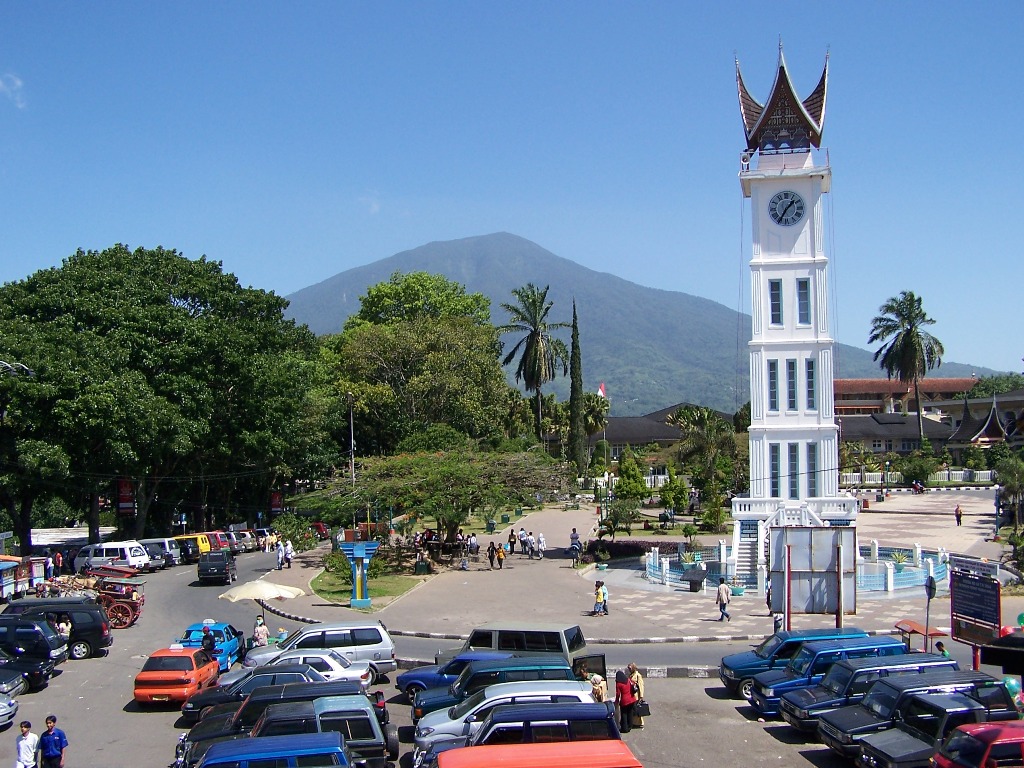
Solok
Solok (means valley) is a city in West Sumatra, Indonesia. Its motto is Kota Beras, which means "the rice city". It has an area of 57.64 km² and a population of 62,483 people in 2014.
Solok Wikipedia Page

About Our Data
The data on this page is estimated using a number of publicly available tools and resources. It is provided without warranty, and could contain inaccuracies. Use at your own risk.