Categories in Ternate
Industries
Business Distribution by Industry in Ternate
| Industry Description | Number of Establishments |
|---|---|
| Shopping | 451 |
| Restaurants | 317 |
| Cafes | 266 |
| Religion | 239 |
| Corporate management | 233 |
| Education | 210 |
| Other accommodation | 170 |
| Public administration | 163 |
| Travel and transportation | 139 |
| Clothing stores | 134 |
| Grocery stores and supermarkets | 124 |
| Electronics stores | 108 |
| Pharmacies and drug stores | 95 |
Ternate Facts
| Area | 41.4 km² |
| Population | 195,921 |
| Male Population | 99,672 (50.9%) |
| Female Population | 96,249 (49.1%) |
| Population change (1975 to 2020) | +9760.1% |
| Population change (2000 to 2020) | +39.2% |
| Median Age | 24.2 years (Male: 24.1, Female: 24.3) |
| Area Codes | 921 |
| Neighborhoods | Gamalama, Central Ternate, Kalumpang, Central Ternate, Ternate, Kalumata, South Ternate, Jalan Baru, Jailolo |
| Local Time | |
| Timezone | Eastern Indonesia Time |
| Lat & Lng | 0.79065, 127.38424 |
| Postal Codes | 97711, 97712, 97713, 97714, 97715, More |
Map of Ternate
Interactive Map
Ternate Population
Years 1975 to 2020
| Data | 1975 | 1990 | 2000 | 2015 | 2020 |
|---|---|---|---|---|---|
| Population | 1,987 | 1,859 | 140,796 | 192,934 | 195,921 |
| Population Density | 48 / km² | 44.9 / km² | 3,397.8 / km² | 4,656 / km² | 4,728.1 / km² |
Ternate Population change from 2000 to 2015
Increase of 37% from year 2000 to 2015
| Location | Change since 1975 | Change since 1990 | Change since 2000 |
|---|---|---|---|
| Ternate | +9609.8% | +10278.4% | +37% |
| North Maluku | — | — | — |
| Indonesia | +96.9% | +41.9% | +21.7% |
Ternate Median Age
Median Age: 24.2 years
| Location | Median Age | Median Age (Female) | Median Age (Male) |
|---|---|---|---|
| Ternate | 24.2 yrs | 24.3 yrs | 24.1 yrs |
| Indonesia | 27.2 yrs | 27.5 yrs | 26.9 yrs |
Ternate Population Density
Population Density: 4,728 / km²
| Location | Population | Area | Density |
|---|---|---|---|
| Ternate | 195,921 | 41.4 km² | 4,728 / km² |
| Indonesia | 252.8 million | 1,893,657.8 km² | 134 / km² |
Ternate Historical and Projected Population
Estimated Population from 1975 to 2100
- JRC (European Commission's Joint Research Centre) work on the GHS built-up grid
- CIESIN (Center for International Earth Science Information Network)
- [Link] Klein Goldewijk, K., Beusen, A., Doelman, J., and Stehfest, E.: Anthropogenic land use estimates for the Holocene – HYDE 3.2, Earth Syst. Sci. Data, 9, 927–953, https://doi.org/10.5194/essd-9-927-2017, 2017.
Neighborhoods in Ternate
Percentage of businesses by neighborhood in Ternate
Area Codes
Percentage Area Codes used by businesses in Ternate
Postal Codes
Percentage of businesses by Postal Codes in Ternate
Price Distribution
Business distribution by price for Ternate
Human Development Index (HDI)
Statistic composite index of life expectancy, education, and per capita income.
Ternate CO2 Emissions
Carbon Dioxide (CO2) Emissions Per Capita in Tonnes Per Year
| Location | CO2 Emissions | CO2 Emissions Per Capita | CO2 Emissions Intensity |
|---|---|---|---|
| Ternate | 124,705 tn | 0.64 tn | 3,009.5 tons/km² |
| Indonesia | 478,610,416 tn | 1.89 tn | 252.7 tons/km² |
| 2013 CO2 emissions (tonnes/year) | 124,705 tn |
| 2013 CO2 emissions (tonnes/year) per capita | 0.64 tn |
| 2013 CO2 emissions intensity (tonnes/km²/year) | 3,009.5 tons/km² |
Natural Hazards Risk
Relative risk out of 10
| Hazard | Risk Level |
|---|---|
| Drought | High (7.9) |
| Earthquake | Medium (3.1) |
| Landslide | High (9) |
| Volcano | High (10) |
* Risk, particularly concerning flood or landslide, may not be for the entire area.
- Dilley, M., R.S. Chen, U. Deichmann, A.L. Lerner-Lam, M. Arnold, J. Agwe, P. Buys, O. Kjekstad, B. Lyon, and G. Yetman. 2005. Natural Disaster Hotspots: A Global Risk Analysis. Washington, D.C.: World Bank. https://doi.org/10.1596/0-8213-5930-4.
- Center for Hazards and Risk Research - CHRR - Columbia University, Center for International Earth Science Information Network - CIESIN - Columbia University, and Norwegian Geotechnical Institute - NGI. 2005. Global Landslide Hazard Distribution. Palisades, NY: NASA Socioeconomic Data and Applications Center (SEDAC). https://doi.org/10.7927/H4P848VZ.
- Center for Hazards and Risk Research - CHRR - Columbia University, Center for International Earth Science Information Network - CIESIN - Columbia University, and International Research Institute for Climate and Society - IRI - Columbia University. 2005. Global Drought Hazard Frequency and Distribution. Palisades, NY: NASA Socioeconomic Data and Applications Center (SEDAC). https://doi.org/10.7927/H4VX0DFT.
- Center for Hazards and Risk Research - CHRR - Columbia University, Center for International Earth Science Information Network - CIESIN - Columbia University. 2005. Global Volcano Hazard Frequency and Distribution. Palisades, NY: NASA Socioeconomic Data and Applications Center (SEDAC). https://doi.org/10.7927/H4BR8Q45.
- Center for Hazards and Risk Research - CHRR - Columbia University, Center for International Earth Science Information Network - CIESIN - Columbia University. 2005. Global Earthquake Hazard Distribution - Peak Ground Acceleration. Palisades, NY: NASA Socioeconomic Data and Applications Center (SEDAC). https://doi.org/10.7927/H4BZ63ZS.
Recent Nearby Earthquakes
Magnitude 3.0 and greater
| Date▼ | Time↕ | Magnitude↕ | Distance↕ | Depth↕ | Location↕ | Link |
|---|---|---|---|---|---|---|
| 9/28/17 | 5:00 PM | 4.8 | 29.6 km | 24,610 m | 27km NE of Ternate, Indonesia | usgs.gov |
| 9/28/17 | 10:20 AM | 4.3 | 21.2 km | 10,000 m | 19km NE of Ternate, Indonesia | usgs.gov |
| 9/28/17 | 6:32 AM | 4.4 | 21.8 km | 10,000 m | 19km ENE of Ternate, Indonesia | usgs.gov |
| 9/28/17 | 4:29 AM | 4.6 | 18.2 km | 17,010 m | 16km ENE of Ternate, Indonesia | usgs.gov |
| 9/27/17 | 10:37 PM | 4.1 | 31.1 km | 10,000 m | 29km NNE of Ternate, Indonesia | usgs.gov |
| 9/17/17 | 4:30 PM | 4.3 | 19 km | 157,830 m | 18km NW of Kota Ternate, Indonesia | usgs.gov |
| 4/18/17 | 2:47 PM | 4 | 3.3 km | 17,190 m | 1km N of Ternate, Indonesia | usgs.gov |
| 2/23/16 | 9:01 PM | 4.5 | 26.9 km | 9,940 m | 25km NNE of Ternate, Indonesia | usgs.gov |
| 2/23/16 | 8:47 PM | 5.4 | 30.7 km | 13,700 m | 29km N of Ternate, Indonesia | usgs.gov |
| 1/19/16 | 11:38 PM | 4.6 | 21.6 km | 11,770 m | 19km NNE of Ternate, Indonesia | usgs.gov |
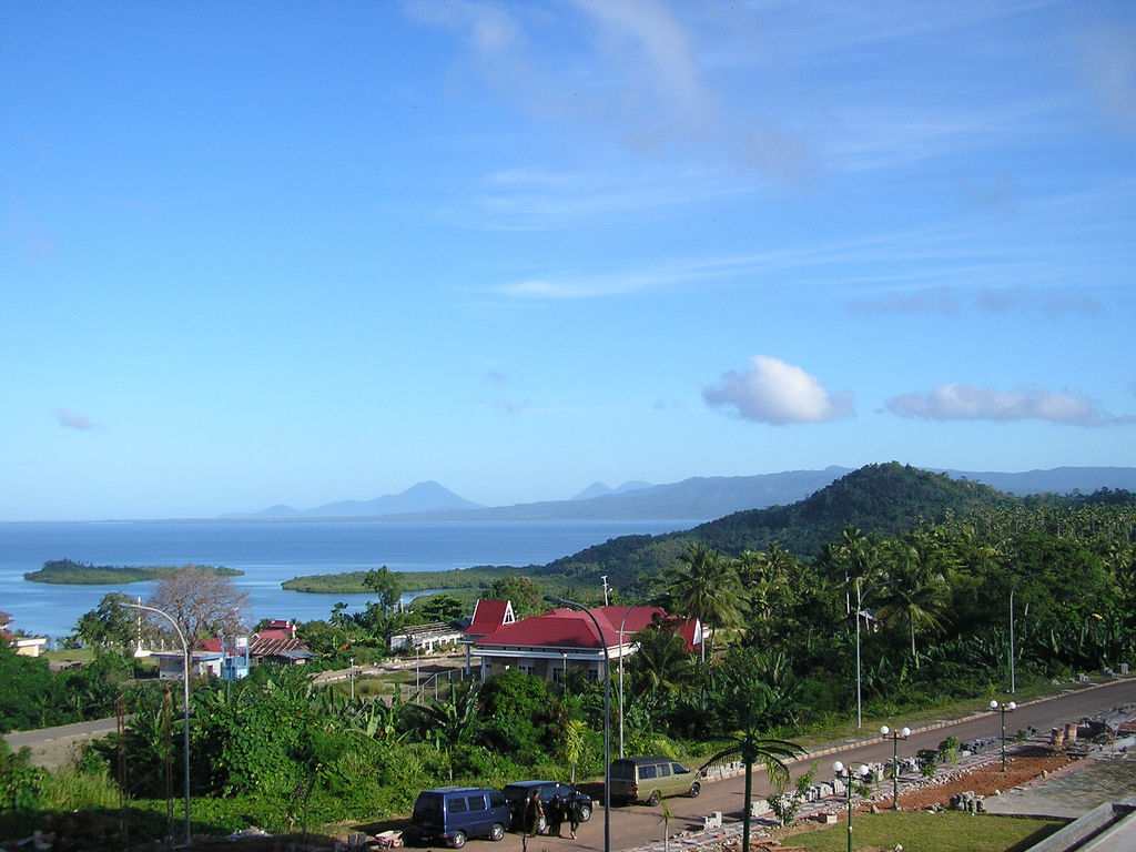
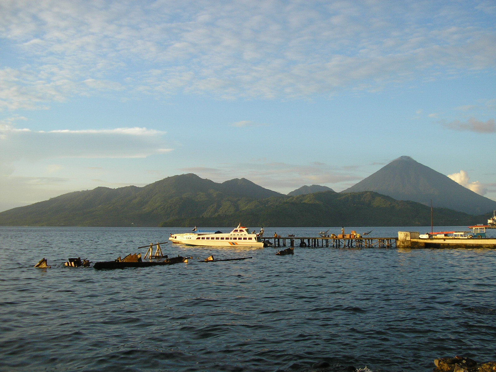
Ternate
Ternate is an island in the Maluku Islands (Moluccas) of eastern Indonesia. It was the center of the powerful former Sultanate of Ternate. It is off the west coast of the larger island of Halmahera. The city has a population of just under 200,000 on ..
Ternate Wikipedia Page

About Our Data
The data on this page is estimated using a number of publicly available tools and resources. It is provided without warranty, and could contain inaccuracies. Use at your own risk.