Categories in Vasto
Industries
Business Distribution by Industry in Vasto
| Industry Description | Number of Establishments |
|---|---|
| Shopping | 254 |
| Restaurants | 236 |
| Other accommodation | 201 |
| Lawyers legal | 167 |
| Corporate management | 161 |
| Clothing stores | 146 |
| Bars, pubs and taverns | 134 |
| Grocery stores and supermarkets | 97 |
| Construction of buildings | 91 |
| Real estate | 87 |
| All food and beverage | 83 |
| Health and medical | 80 |
| Beauty salons | 76 |
| Hairdressers | 69 |
| Car repair | 68 |
| Electronics stores | 66 |
Vasto Facts
| Area | 3.1 km² |
| Population | 24,189 |
| Male Population | 11,763 (48.6%) |
| Female Population | 12,426 (51.4%) |
| Population change (1975 to 2020) | +37.3% |
| Population change (2000 to 2020) | +13.8% |
| Median Age | 42 years (Male: 40.7, Female: 43.2) |
| Area Codes | 873 |
| Neighborhoods | Nomentano, Sant'Antonio |
| Local Time | |
| Timezone | Central European Summer Time |
| Lat & Lng | 42.11150, 14.70649 |
| Postal Codes | 66054 |
Map of Vasto
Interactive Map
Vasto Population
Years 1975 to 2020
| Data | 1975 | 1990 | 2000 | 2015 | 2020 |
|---|---|---|---|---|---|
| Population | 17,619 | 19,977 | 21,261 | 23,893 | 24,189 |
| Population Density | 5,753.1 / km² | 6,523.1 / km² | 6,942.4 / km² | 7,801.8 / km² | 7,898.4 / km² |
Vasto Population change from 2000 to 2015
Increase of 12.4% from year 2000 to 2015
| Location | Change since 1975 | Change since 1990 | Change since 2000 |
|---|---|---|---|
| Vasto | +35.6% | +19.6% | +12.4% |
| Italy | +8.3% | +4.9% | +4.7% |
Vasto Median Age
Median Age: 42 years
| Location | Median Age | Median Age (Female) | Median Age (Male) |
|---|---|---|---|
| Vasto | 42 yrs | 43.2 yrs | 40.7 yrs |
| Italy | 40.9 yrs | 41.5 yrs | 40.3 yrs |
Vasto Population Density
Population Density: 7,898 / km²
| Location | Population | Area | Density |
|---|---|---|---|
| Vasto | 24,189 | 3.063 km² | 7,898 / km² |
| Italy | 59.3 million | 301,510.7 km² | 197 / km² |
Vasto Historical and Projected Population
Estimated Population from 1200 to 2100
- JRC (European Commission's Joint Research Centre) work on the GHS built-up grid
- CIESIN (Center for International Earth Science Information Network)
- [Link] Klein Goldewijk, K., Beusen, A., Doelman, J., and Stehfest, E.: Anthropogenic land use estimates for the Holocene – HYDE 3.2, Earth Syst. Sci. Data, 9, 927–953, https://doi.org/10.5194/essd-9-927-2017, 2017.
Area Codes
Percentage Area Codes used by businesses in Vasto
Price Distribution
Business distribution by price for Vasto
Human Development Index (HDI)
Statistic composite index of life expectancy, education, and per capita income.
Vasto CO2 Emissions
Carbon Dioxide (CO2) Emissions Per Capita in Tonnes Per Year
| Location | CO2 Emissions | CO2 Emissions Per Capita | CO2 Emissions Intensity |
|---|---|---|---|
| Vasto | 165,365 tn | 6.84 tn | 53,996.8 tons/km² |
| Italy | 399,008,505 tn | 6.73 tn | 1,323.4 tons/km² |
| 2013 CO2 emissions (tonnes/year) | 165,365 tn |
| 2013 CO2 emissions (tonnes/year) per capita | 6.84 tn |
| 2013 CO2 emissions intensity (tonnes/km²/year) | 53,996.8 tons/km² |
Natural Hazards Risk
Relative risk out of 10
| Hazard | Risk Level |
|---|---|
| Flood | Medium (4) |
| Earthquake | Medium (4) |
* Risk, particularly concerning flood or landslide, may not be for the entire area.
- Dilley, M., R.S. Chen, U. Deichmann, A.L. Lerner-Lam, M. Arnold, J. Agwe, P. Buys, O. Kjekstad, B. Lyon, and G. Yetman. 2005. Natural Disaster Hotspots: A Global Risk Analysis. Washington, D.C.: World Bank. https://doi.org/10.1596/0-8213-5930-4.
- Center for Hazards and Risk Research - CHRR - Columbia University, Center for International Earth Science Information Network - CIESIN - Columbia University. 2005. Global Flood Hazard Frequency and Distribution. Palisades, NY: NASA Socioeconomic Data and Applications Center (SEDAC). https://doi.org/10.7927/H4668B3D.
- Center for Hazards and Risk Research - CHRR - Columbia University, Center for International Earth Science Information Network - CIESIN - Columbia University. 2005. Global Earthquake Hazard Distribution - Peak Ground Acceleration. Palisades, NY: NASA Socioeconomic Data and Applications Center (SEDAC). https://doi.org/10.7927/H4BZ63ZS.
Recent Nearby Earthquakes
Magnitude 3.0 and greater
| Date▼ | Time↕ | Magnitude↕ | Distance↕ | Depth↕ | Location↕ | Link |
|---|---|---|---|---|---|---|
| 8/16/18 | 8:22 PM | 4.5 | 31.1 km | 3,240 m | 3km NNW of Guardialfiera, Italy | usgs.gov |
| 8/16/18 | 6:19 PM | 5.3 | 27.6 km | 11,590 m | 2km SE of Palata, Italy | usgs.gov |
| 8/14/18 | 9:48 PM | 4.6 | 27 km | 10,000 m | 1km SE of Palata, Italy | usgs.gov |
| 4/25/18 | 9:48 AM | 4.3 | 24.5 km | 10,000 m | 1km W of Montecilfone, Italy | usgs.gov |
| 1/16/16 | 6:55 PM | 4.4 | 58.7 km | 5,400 m | 3km NNW of Campobasso, Italy | usgs.gov |
| 12/6/15 | 4:24 PM | 4.6 | 49.3 km | 3,990 m | 44km NNE of Termoli, Italy | usgs.gov |
| 12/6/15 | 3:22 AM | 4.5 | 57.8 km | 5,500 m | 56km NE of Vasto, Italy | usgs.gov |
| 12/6/15 | 3:21 AM | 4.1 | 48.1 km | 17,860 m | 46km NNE of Termoli, Italy | usgs.gov |
| 12/24/14 | 11:40 AM | 4.4 | 50.4 km | 17,600 m | 1km NNW of San Giuliano di Puglia, Italy | usgs.gov |
| 10/18/07 | 11:25 PM | 4 | 48.6 km | 10,000 m | southern Italy | usgs.gov |
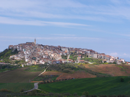
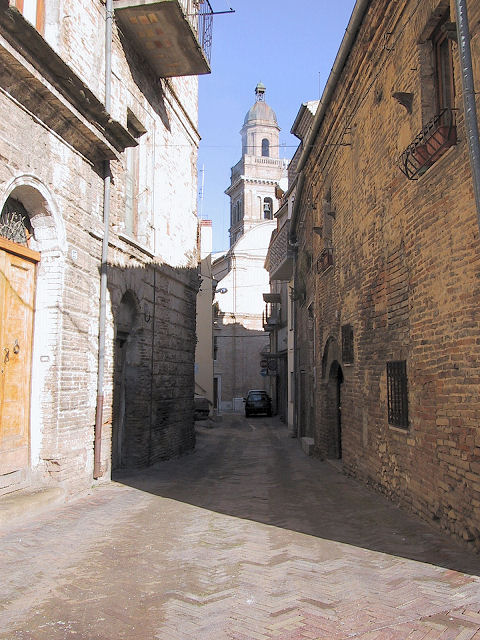
Vasto
The Città del Vasto or Vasto (from the Greek Ἱστόνιον, Latin Histonium) is a town and comune on the Adriatic coast of the Province of Chieti in southern Abruzzo, Italy. It was also called in the Middle Ages as Guastaymonis or Il Vasto d'Ammone and al..
Vasto Wikipedia Page

About Our Data
The data on this page is estimated using a number of publicly available tools and resources. It is provided without warranty, and could contain inaccuracies. Use at your own risk.