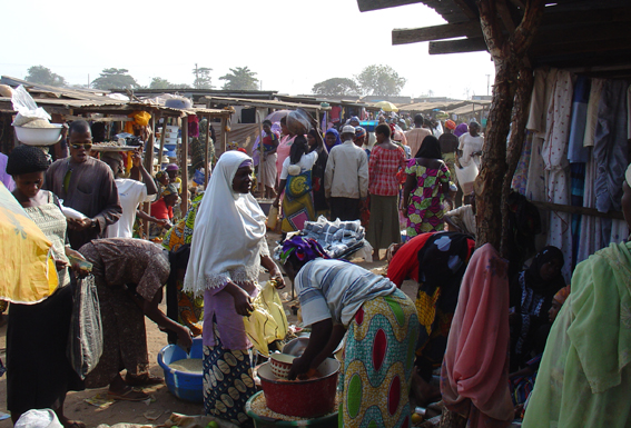
Categories in Nasarawa
Auto Accessories WholesalerAuto Bodywork MechanicAuto MarketAuto Parts StoreAuto Restoration ServiceCar repairCar WashGas stationGas StationMechanicNew car dealersAgricultural Machinery ManufacturerAgricultural ProductionAgricultural wholesaleAgrochemicals SupplierAluminium Products ManufacturerAluminum SupplierAluminum WelderAluminum WindowBeauty Product SupplierBeverage DistributorBottled Water SupplierBuilding Materials SupplierCement SupplierClothing SupplierClothing WholesalerCommercial PrinterComputer hardware manufacturerComputer WholesalerCosmetic Products ManufacturerDigital Printing ServiceEgg SupplierElectrical Appliance WholesalerElectronic Parts SupplierElectronics WholesalerEquipment supplierFarm Equipment SupplierFarmingFish FarmFitted Furniture SupplierFoam Rubber ProducerFood BrokerFood ManufacturerFood ProducerFood Products SupplierFuel supplierFurniture MakerFurniture ManufacturerFurniture WholesalerGenerator Shop
Showing 1-50 of 362
…
Industries
Business Distribution by Industry in Nasarawa
| Industry Description | Number of Establishments |
|---|---|
| Education | 168 |
| Churches | 120 |
| Shopping other | 117 |
| Shopping | 104 |
| Hotels and motels | 81 |
| Corporate management | 75 |
| Hospitals | 62 |
Nasarawa Facts
| Area | 4.3 km² |
| Population | 49,488 |
| Male Population | 25,139 (50.8%) |
| Female Population | 24,349 (49.2%) |
| Population change (1975 to 2020) | +424.0% |
| Population change (2000 to 2020) | +66.9% |
| Median Age | 17.1 years (Male: 16.8, Female: 17.5) |
| Neighborhoods | Karu, Nyanya, Garki, Eti-Osa, Mararaba |
| Local Time | |
| Timezone | West Africa Time |
| Lat & Lng | 8.53895, 7.70821 |
| Postal Codes | 962102, 962103 |
Map of Nasarawa
Interactive Map
Nasarawa Population
Years 1975 to 2020
| Data | 1975 | 1990 | 2000 | 2015 | 2020 |
|---|---|---|---|---|---|
| Population | 9,445 | 26,947 | 29,659 | 43,913 | 49,488 |
| Population Density | 2,222.4 / km² | 6,340.5 / km² | 6,978.6 / km² | 10,332.5 / km² | 11,644.2 / km² |
Sources: JRC (European Commission's Joint Research Centre) work on the GHS built-up grid
Nasarawa Population change from 2000 to 2015
Increase of 48.1% from year 2000 to 2015
| Location | Change since 1975 | Change since 1990 | Change since 2000 |
|---|---|---|---|
| Nasarawa | +364.9% | +63% | +48.1% |
| Nasarawa State | +164.4% | +80.6% | +43.4% |
| Nigeria | +186.7% | +90.6% | +48.3% |
Sources: JRC (European Commission's Joint Research Centre) work on the GHS built-up grid
Nasarawa Median Age
Median Age: 17.1 years
| Location | Median Age | Median Age (Female) | Median Age (Male) |
|---|---|---|---|
| Nasarawa | 17.1 yrs | 17.5 yrs | 16.8 yrs |
| Nasarawa State | 17 yrs | 17.4 yrs | 16.6 yrs |
| Nigeria | 18.9 yrs | 19.3 yrs | 18.5 yrs |
Sources: CIESIN (Center for International Earth Science Information Network)
Nasarawa Population Density
Population Density: 11,644 / km²
| Location | Population | Area | Density |
|---|---|---|---|
| Nasarawa | 49,488 | 4.25 km² | 11,644 / km² |
| Nasarawa State | 2.3 million | 26,677.8 km² | 86.6 / km² |
| Nigeria | 182 million | 909,042.9 km² | 200 / km² |
Sources: JRC (European Commission's Joint Research Centre) work on the GHS built-up grid
Nasarawa Historical and Projected Population
Estimated Population from 1720 to 2100
Sources:
- JRC (European Commission's Joint Research Centre) work on the GHS built-up grid
- CIESIN (Center for International Earth Science Information Network)
- [Link] Klein Goldewijk, K., Beusen, A., Doelman, J., and Stehfest, E.: Anthropogenic land use estimates for the Holocene – HYDE 3.2, Earth Syst. Sci. Data, 9, 927–953, https://doi.org/10.5194/essd-9-927-2017, 2017.
Area Codes
Percentage Area Codes used by businesses in Nasarawa
Price Distribution
Business distribution by price for Nasarawa
Human Development Index (HDI)
Statistic composite index of life expectancy, education, and per capita income.
Source: [Link] Kummu, M., Taka, M. &Guillaume, J. Gridded global datasets for Gross Domestic Product and Human Development Index over 1990–2015. Sci Data 5, 180004 (2018) doi:10.1038/sdata.2018.4
Nasarawa CO2 Emissions
Carbon Dioxide (CO2) Emissions Per Capita in Tonnes Per Year
| Location | CO2 Emissions | CO2 Emissions Per Capita | CO2 Emissions Intensity |
|---|---|---|---|
| Nasarawa | 25,326 tn | 0.51 tn | 5,959.1 tons/km² |
| Nasarawa State | 1,182,378 tn | 0.51 tn | 44.3 tons/km² |
| Nigeria | 86,705,254 tn | 0.48 tn | 95.4 tons/km² |
Sources: [Link] Moran, D., Kanemoto K; Jiborn, M., Wood, R., Többen, J., and Seto, K.C. (2018) Carbon footprints of 13,000 cities. Environmental Research Letters DOI: 10.1088/1748-9326/aac72a
Nasarawa CO2 Emissions
| 2013 CO2 emissions (tonnes/year) | 25,326 tn |
| 2013 CO2 emissions (tonnes/year) per capita | 0.51 tn |
| 2013 CO2 emissions intensity (tonnes/km²/year) | 5,959.1 tons/km² |
Natural Hazards Risk
Relative risk out of 10
| Hazard | Risk Level |
|---|---|
| Drought | Low (2) |
* Risk, particularly concerning flood or landslide, may not be for the entire area.
Sources:
- Dilley, M., R.S. Chen, U. Deichmann, A.L. Lerner-Lam, M. Arnold, J. Agwe, P. Buys, O. Kjekstad, B. Lyon, and G. Yetman. 2005. Natural Disaster Hotspots: A Global Risk Analysis. Washington, D.C.: World Bank. https://doi.org/10.1596/0-8213-5930-4.
- Center for Hazards and Risk Research - CHRR - Columbia University, Center for International Earth Science Information Network - CIESIN - Columbia University, and International Research Institute for Climate and Society - IRI - Columbia University. 2005. Global Drought Hazard Frequency and Distribution. Palisades, NY: NASA Socioeconomic Data and Applications Center (SEDAC). https://doi.org/10.7927/H4VX0DFT.

About Our Data
The data on this page is estimated using a number of publicly available tools and resources. It is provided without warranty, and could contain inaccuracies. Use at your own risk.