Categories in Bhimdatta
Motorcycle repairAgricultural ProductionFarmingWholesalersClothing storesCommunity CenterHindu templeElectronics StoreHardware storeHousing DevelopmentEducationUniversities & CollegesTourist AttractionBakeriesGrocery stores and supermarketsRestaurantsBanksApartment BuildingHousing ComplexGeneral StoreShoppingShopping MallPublic parksHotelsHotels and motelsHousing SocietyUnreachable
Map of Bhimdatta
Interactive Map
Area Codes
Percentage Area Codes used by businesses in Bhimdatta
Postal Codes
Percentage of businesses by Postal Codes in Bhimdatta
Recent Nearby Earthquakes
Magnitude 3.0 and greater
| Date▼ | Time↕ | Magnitude↕ | Distance↕ | Depth↕ | Location↕ | Link |
|---|---|---|---|---|---|---|
| 8/22/17 | 12:50 AM | 4.6 | 95.5 km | 10,000 m | 25km NE of Dipayal, Nepal | usgs.gov |
| 7/2/16 | 12:23 AM | 4.4 | 99.6 km | 10,000 m | 31km NNE of Dipayal, Nepal | usgs.gov |
| 1/22/15 | 3:42 AM | 4 | 87.1 km | 40,660 m | 17km NE of Dipayal, Nepal | usgs.gov |
| 7/7/14 | 4:37 PM | 4.4 | 93.1 km | 16,320 m | 23km NE of Dipayal, Nepal | usgs.gov |
| 1/2/13 | 5:42 PM | 4.7 | 98 km | 10,000 m | 31km ENE of Dipayal, Nepal | usgs.gov |
| 4/4/11 | 11:31 AM | 5.3 | 95.8 km | 26,100 m | Nepal-India border region | usgs.gov |
| 1/11/10 | 5:15 AM | 4.7 | 94.2 km | 35,000 m | Nepal-India border region | usgs.gov |
| 6/15/08 | 3:27 AM | 4.6 | 94.5 km | 29,000 m | Nepal | usgs.gov |
| 3/10/07 | 1:25 PM | 4.6 | 97.9 km | 5,800 m | Nepal | usgs.gov |
| 2/12/07 | 3:53 PM | 3.6 | 71.7 km | 10,000 m | Nepal-India border region | usgs.gov |
Source: U.S. Geological Survey (USGS)
Bhimdatta
Bhimdatta (Nepali: भीमदत्त), formerly known as Mahendranagar (महेन्द्रनगर), is a city and municipality in far western Nepal, 5 kilometres (3.1 mi) from the border of India and the Mahakali River. It is the headquarters of the district of Kanchanpur i..
Bhimdatta Wikipedia Page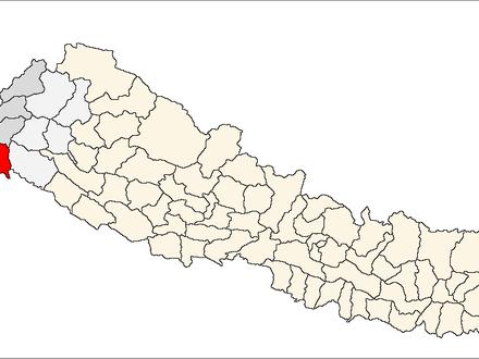

About Our Data
The data on this page is estimated using a number of publicly available tools and resources. It is provided without warranty, and could contain inaccuracies. Use at your own risk.