Categories in Dhankuta
Car repairGas StationMotorcycle repairAgricultural ProductionAgricultural wholesaleFarmingTea ManufacturerClothing storesShoe storesInternet Service ProviderMobile phone storesBuddhist templeChurchesCity Government OfficeCivil PoliceCommunity CenterFederal PoliceGovernment OfficeHindu templeLocal Government OfficeNon-Profit OrganizationPost OfficeReligionReligious DestinationSocial Services OrganizationSoup KitchenState PoliceVillage HallElectronics StoreMobile Phone Repair ShopBridgeConstruction of housesHardware storeHome Goods StoreHousing DevelopmentCollegeEducationEducation CenterElementary SchoolGovernment SchoolHigher Secondary SchoolHigh SchoolHome HelpMiddle SchoolPrimary SchoolUniversityMuseumsNational ForestPhoto LabTourist Attraction
Showing 1-50 of 100
Industries
Business Distribution by Industry in Dhankuta
| Industry Description | Number of Establishments |
|---|---|
| Education | 157 |
| Shopping | 102 |
| Hotels and motels | 90 |
| Public administration | 84 |
| Restaurants | 47 |
| Religion | 44 |
| Hindu temple | 37 |
| Hospitals | 34 |
| Clothing stores | 33 |
| Banks | 31 |
| Electronics stores | 31 |
| Travel and transportation | 30 |
Map of Dhankuta
Interactive Map
Neighborhoods in Dhankuta
Percentage of businesses by neighborhood in Dhankuta
Area Codes
Percentage Area Codes used by businesses in Dhankuta
Recent Nearby Earthquakes
Magnitude 3.0 and greater
| Date▼ | Time↕ | Magnitude↕ | Distance↕ | Depth↕ | Location↕ | Link |
|---|---|---|---|---|---|---|
| 1/22/19 | 4:45 PM | 4.3 | 51 km | 10,000 m | 15km NW of Bhojpur, Nepal | usgs.gov |
| 6/20/18 | 4:15 AM | 4.4 | 51.1 km | 52,910 m | 29km NNW of Ilam, Nepal | usgs.gov |
| 6/20/18 | 4:08 AM | 4.4 | 17.2 km | 38,300 m | 17km E of Dhankuta, Nepal | usgs.gov |
| 12/2/17 | 11:43 PM | 4.2 | 81.3 km | 10,000 m | 24km NW of Naya Bazar, India | usgs.gov |
| 5/16/17 | 10:13 PM | 4.2 | 91.4 km | 10,000 m | 23km NNW of Naya Bazar, India | usgs.gov |
| 8/15/15 | 5:42 AM | 4.4 | 67.7 km | 10,000 m | 48km WNW of Naya Bazar, India | usgs.gov |
| 4/27/15 | 12:35 PM | 5.1 | 72.9 km | 31,710 m | 13km ESE of Ilam, Nepal | usgs.gov |
| 12/8/13 | 2:19 PM | 4 | 87.1 km | 44,810 m | 55km NE of Khandbari, Nepal | usgs.gov |
| 4/19/13 | 6:35 AM | 4.2 | 64.5 km | 47,100 m | 46km WNW of Naya Bazar, India | usgs.gov |
| 11/30/12 | 7:39 PM | 4.7 | 89.9 km | 25,000 m | Sikkim, India | usgs.gov |
Source: U.S. Geological Survey (USGS)
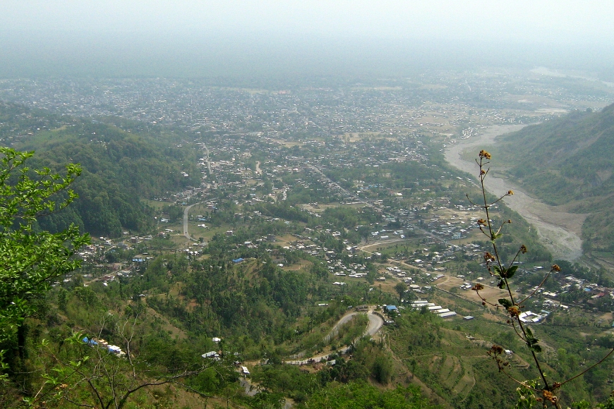
Dhankuta
Dhankuta (Nepali: धनकुटा listen ) is a hill town and the headquarter of Koshi Zone located in Dhankuta District of Eastern Nepal. According to 2011 Nepal census, it has population of 26,440 inhabitants.
Dhankuta Wikipedia Page

About Our Data
The data on this page is estimated using a number of publicly available tools and resources. It is provided without warranty, and could contain inaccuracies. Use at your own risk.