Categories in Esmoriz
Industries
Business Distribution by Industry in Esmoriz
| Industry Description | Number of Establishments | Average Age of Business |
|---|---|---|
| Restaurants | 70 | — |
| Shopping | 61 | 33 years |
| Cafes | 42 | — |
| Corporate management | 41 | 25 years |
| Real estate | 29 | 27 years |
| Bars, pubs and taverns | 27 | — |
| Beauty salons | 27 | — |
| Furniture stores | 24 | — |
| Car repair | 24 | — |
| Clothing stores | 23 | — |
| Grocery stores and supermarkets | 21 | — |
| Education | 19 | — |
| Hardware store | 19 | — |
Esmoriz Facts
| Area | 2.3 km² |
| Population | 4,802 |
| Male Population | 2,307 (48.0%) |
| Female Population | 2,495 (52.0%) |
| Population change (1975 to 2020) | +15.9% |
| Population change (2000 to 2020) | +2.0% |
| Median Age | 39.8 years (Male: 38.9, Female: 40.7) |
| Neighborhoods | Matosinhos, Belo Monte, Aldeia Nova, Boa Vista, Souto |
| Local Time | |
| Timezone | Western European Summer Time |
| Lat & Lng | 40.95773, -8.62753 |
| Postal Codes | 3885 |
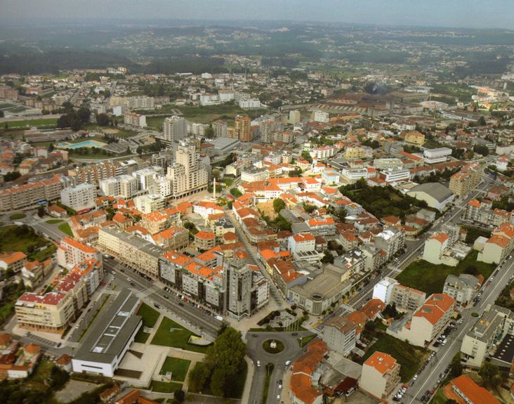
Map of Esmoriz
Interactive Map
Esmoriz Population
Years 1975 to 2020
| Data | 1975 | 1990 | 2000 | 2015 | 2020 |
|---|---|---|---|---|---|
| Population | 4,145 | 4,530 | 4,707 | 4,658 | 4,802 |
| Population Density | 1,792.4 / km² | 1,958.9 / km² | 2,035.5 / km² | 2,014.3 / km² | 2,076.5 / km² |
Esmoriz Population change from 2000 to 2015
Decrease of 1% from year 2000 to 2015
| Location | Change since 1975 | Change since 1990 | Change since 2000 |
|---|---|---|---|
| Esmoriz | +12.4% | +2.8% | -1% |
| Aveiro District | +1.5% | -2.8% | -4% |
| Portugal | +12.6% | +4.6% | +0.7% |
Esmoriz Median Age
Median Age: 39.8 years
| Location | Median Age | Median Age (Female) | Median Age (Male) |
|---|---|---|---|
| Esmoriz | 39.8 yrs | 40.7 yrs | 38.9 yrs |
| Aveiro District | 41.9 yrs | 43.1 yrs | 40.6 yrs |
| Portugal | 42 yrs | 43.5 yrs | 40.4 yrs |
Esmoriz Population Density
Population Density: 2,077 / km²
| Location | Population | Area | Density |
|---|---|---|---|
| Esmoriz | 4,802 | 2.313 km² | 2,077 / km² |
| Aveiro District | 689,994 | 2,805.2 km² | 246 / km² |
| Portugal | 10.3 million | 92,264.9 km² | 112 / km² |
Esmoriz Historical and Projected Population
Estimated Population from 1200 to 2100
- JRC (European Commission's Joint Research Centre) work on the GHS built-up grid
- CIESIN (Center for International Earth Science Information Network)
- [Link] Klein Goldewijk, K., Beusen, A., Doelman, J., and Stehfest, E.: Anthropogenic land use estimates for the Holocene – HYDE 3.2, Earth Syst. Sci. Data, 9, 927–953, https://doi.org/10.5194/essd-9-927-2017, 2017.
Neighborhoods in Esmoriz
Percentage of businesses by neighborhood in Esmoriz
Area Codes
Percentage Area Codes used by businesses in Esmoriz
Postal Codes
Percentage of businesses by Postal Codes in Esmoriz
Price Distribution
Business distribution by price for Esmoriz
Human Development Index (HDI)
Statistic composite index of life expectancy, education, and per capita income.
Esmoriz CO2 Emissions
Carbon Dioxide (CO2) Emissions Per Capita in Tonnes Per Year
| Location | CO2 Emissions | CO2 Emissions Per Capita | CO2 Emissions Intensity |
|---|---|---|---|
| Esmoriz | 30,221 tn | 6.29 tn | 13,068.5 tons/km² |
| Aveiro District | 4,361,682 tn | 6.32 tn | 1,554.9 tons/km² |
| Portugal | 63,833,570 tn | 6.2 tn | 691.9 tons/km² |
| 2013 CO2 emissions (tonnes/year) | 30,221 tn |
| 2013 CO2 emissions (tonnes/year) per capita | 6.29 tn |
| 2013 CO2 emissions intensity (tonnes/km²/year) | 13,068.5 tons/km² |
Natural Hazards Risk
Relative risk out of 10
| Hazard | Risk Level |
|---|---|
| Flood | Medium (7) |
| Earthquake | Medium (4) |
* Risk, particularly concerning flood or landslide, may not be for the entire area.
- Dilley, M., R.S. Chen, U. Deichmann, A.L. Lerner-Lam, M. Arnold, J. Agwe, P. Buys, O. Kjekstad, B. Lyon, and G. Yetman. 2005. Natural Disaster Hotspots: A Global Risk Analysis. Washington, D.C.: World Bank. https://doi.org/10.1596/0-8213-5930-4.
- Center for Hazards and Risk Research - CHRR - Columbia University, Center for International Earth Science Information Network - CIESIN - Columbia University. 2005. Global Flood Hazard Frequency and Distribution. Palisades, NY: NASA Socioeconomic Data and Applications Center (SEDAC). https://doi.org/10.7927/H4668B3D.
- Center for Hazards and Risk Research - CHRR - Columbia University, Center for International Earth Science Information Network - CIESIN - Columbia University. 2005. Global Earthquake Hazard Distribution - Peak Ground Acceleration. Palisades, NY: NASA Socioeconomic Data and Applications Center (SEDAC). https://doi.org/10.7927/H4BZ63ZS.
Recent Nearby Earthquakes
Magnitude 3.0 and greater
| Date▼ | Time↕ | Magnitude↕ | Distance↕ | Depth↕ | Location↕ | Link |
|---|---|---|---|---|---|---|
| 5/2/15 | 1:43 AM | 3.3 | 63.8 km | 20,700 m | 4km SSW of Braga, Portugal | usgs.gov |
| 6/13/97 | 12:17 AM | 3.2 | 97.2 km | 10,000 m | Portugal | usgs.gov |
| 3/9/97 | 6:11 AM | 3.1 | 99.1 km | 10,000 m | Portugal | usgs.gov |
| 12/31/96 | 5:44 PM | 3.5 | 62.8 km | 10,000 m | Portugal | usgs.gov |
| 6/8/96 | 11:49 AM | 3.1 | 80.6 km | 10,000 m | Portugal | usgs.gov |
| 4/7/95 | 3:36 PM | 3.1 | 39.4 km | 10,000 m | Portugal | usgs.gov |
| 4/3/95 | 2:44 PM | 3.9 | 71.4 km | 5,000 m | Portugal | usgs.gov |
| 10/20/94 | 6:01 AM | 3.4 | 73.9 km | 10,000 m | Portugal | usgs.gov |
| 8/29/94 | 3:30 AM | 3.1 | 69.2 km | 10,000 m | Portugal | usgs.gov |
| 5/26/94 | 2:13 PM | 3.1 | 47.5 km | 5,000 m | Portugal | usgs.gov |
Esmoriz
Esmoriz (Portuguese pronunciation: [(ɨ)ʒmuˈɾiʃ]) is a Portuguese city located 25 kilometers (16 mi) south of Porto. It belongs to Ovar Municipality. The population in 2011 was 11,448, in an area of 9.17 km². Esmoriz was given city status in 1993.
Esmoriz Wikipedia Page

About Our Data
The data on this page is estimated using a number of publicly available tools and resources. It is provided without warranty, and could contain inaccuracies. Use at your own risk.