Industries
Business Distribution by Industry in Divčibare
| Industry Description | Number of Establishments |
|---|---|
| Other accommodation | 51 |
| Real estate | 36 |
| Holiday homes, cabins and resorts | 17 |
| Hotels and motels | 16 |
| Restaurants | 14 |
| Apartments | 12 |
| Travel and transportation | 6 |
| Travel agencies | 5 |
Divčibare Facts
| Neighborhoods | banja vrujci, Beogradsko naselje |
| Local Time | |
| Timezone | Central European Summer Time |
| Lat & Lng | 44.10600, 19.99250 |
Map of Divčibare
Interactive Map
Area Codes
Percentage Area Codes used by businesses in Divčibare
Postal Codes
Percentage of businesses by Postal Codes in Divčibare
Price Distribution
Business distribution by price for Divčibare
Recent Nearby Earthquakes
Magnitude 3.0 and greater
| Date▼ | Time↕ | Magnitude↕ | Distance↕ | Depth↕ | Location↕ | Link |
|---|---|---|---|---|---|---|
| 3/8/15 | 8:47 PM | 4.4 | 5.1 km | 9,020 m | 16km S of Valjevo, Serbia | usgs.gov |
| 11/4/10 | 9:09 PM | 4.3 | 61.4 km | 11,000 m | Serbia | usgs.gov |
| 9/20/08 | 12:05 AM | 3.1 | 70.8 km | 12,700 m | Serbia | usgs.gov |
| 9/19/08 | 11:19 AM | 3.5 | 68.3 km | 2,600 m | Serbia | usgs.gov |
| 2/21/08 | 4:55 AM | 3.3 | 38.1 km | 12,700 m | Serbia | usgs.gov |
| 2/15/08 | 5:03 PM | 4 | 43 km | 14,200 m | Serbia | usgs.gov |
| 4/23/07 | 2:11 PM | 3.7 | 33.3 km | 3,300 m | Serbia | usgs.gov |
| 1/19/07 | 8:32 AM | 3.2 | 29.9 km | 10,000 m | Serbia | usgs.gov |
| 12/15/06 | 6:05 AM | 3.2 | 11.9 km | 5,000 m | Serbia | usgs.gov |
| 10/29/06 | 11:27 AM | 3.1 | 9.7 km | 11,000 m | Serbia | usgs.gov |
Source: U.S. Geological Survey (USGS)
Divčibare
Divčibare (Serbian Cyrillic: Дивчибаре, pronounced [dǐv̞tʃibarɛ]) is a town and mountain resort situated on the mountain Maljen (1104m) in western Serbia, south-east of Valjevo, at the altitude of 980 metres above sea level. The permanent population ..
Divčibare Wikipedia Page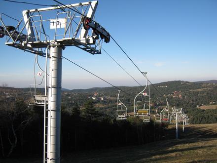


About Our Data
The data on this page is estimated using a number of publicly available tools and resources. It is provided without warranty, and could contain inaccuracies. Use at your own risk.