Industries
Business Distribution by Industry in Otočec
| Industry Description | Number of Establishments |
|---|---|
| Restaurants | 11 |
| Car repair | 9 |
| Other accommodation | 8 |
| Sports and recreation | 6 |
| Technical construction services | 6 |
| Bars, pubs and taverns | 5 |
| Buses and trains | 5 |
Otočec Facts
| Neighborhoods | Otočec, Vrh pri Pahi, Zagrad pri Otočcu |
| Local Time | |
| Timezone | Central European Summer Time |
| Lat & Lng | 45.83967, 15.22528 |
Map of Otočec
Interactive Map
Area Codes
Percentage Area Codes used by businesses in Otočec
Price Distribution
Business distribution by price for Otočec
Recent Nearby Earthquakes
Magnitude 3.0 and greater
| Date▼ | Time↕ | Magnitude↕ | Distance↕ | Depth↕ | Location↕ | Link |
|---|---|---|---|---|---|---|
| 11/1/15 | 7:52 AM | 4.3 | 25.5 km | 2,360 m | 5km SSW of Brezice, Slovenia | usgs.gov |
| 3/13/14 | 5:31 PM | 4.4 | 30.8 km | 2,000 m | 9km E of Ribnica, Slovenia | usgs.gov |
| 6/16/13 | 8:04 PM | 4 | 28 km | 10,000 m | 5km WSW of Zuzemberk, Slovenia | usgs.gov |
| 6/25/08 | 2:09 PM | 3.1 | 15.5 km | 9,400 m | Slovenia | usgs.gov |
| 4/19/08 | 1:49 AM | 3.9 | 36 km | 10,000 m | Slovenia | usgs.gov |
| 12/18/07 | 3:26 AM | 3.1 | 27.1 km | 5,000 m | Croatia | usgs.gov |
| 9/29/07 | 1:24 AM | 3.4 | 13.4 km | 11,000 m | Slovenia | usgs.gov |
| 9/26/07 | 8:38 PM | 3.2 | 27.5 km | 10,000 m | Slovenia | usgs.gov |
| 9/26/07 | 7:47 PM | 3.2 | 25.4 km | 10,000 m | Slovenia | usgs.gov |
| 5/26/07 | 6:03 AM | 3.3 | 38 km | 10,000 m | Croatia | usgs.gov |
Source: U.S. Geological Survey (USGS)
Otočec
Otočec (pronounced [ɔˈtoːtʃəts]) is a settlement on the left bank of the Krka River in the Municipality of Novo Mesto in southeastern Slovenia. The area is part of the traditional region of Lower Carniola and is now included in the Southeast Slovenia..
Otočec Wikipedia Page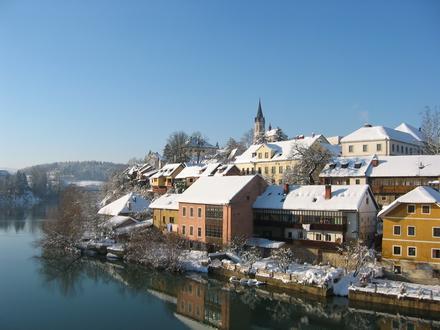


About Our Data
The data on this page is estimated using a number of publicly available tools and resources. It is provided without warranty, and could contain inaccuracies. Use at your own risk.