Categories in Bodrum
Industries
Business Distribution by Industry in Bodrum
| Industry Description | Number of Establishments | Average Age of Business |
|---|---|---|
| Restaurants | 2,249 | 19 years |
| Other accommodation | 1,150 | 24 years |
| Hotels and motels | 668 | — |
| Shopping | 643 | 21 years |
| Real estate | 586 | 19 years |
| Grocery stores and supermarkets | 571 | — |
| Cafes | 442 | — |
| Construction of houses | 363 | — |
| Corporate management | 346 | 16 years |
| Bars, pubs and taverns | 338 | — |
| Clothing stores | 319 | — |
| Construction of buildings | 282 | 26 years |
| Shopping other | 266 | — |
| Beauty salons | 262 | — |
| Car repair | 258 | — |
Bodrum Facts
| Area | 689.8 km² |
| Population | 147,207 |
| Male Population | 76,090 (51.7%) |
| Female Population | 71,117 (48.3%) |
| Population change (1975 to 2020) | +671.1% |
| Population change (2000 to 2020) | +76.2% |
| Median Age | 34 years (Male: 34.2, Female: 33.8) |
| Neighborhoods | Çarşı Mahallesi, Turgutreis Mahallesi, Gümbet Mahallesi, Yalıkavak Mahallesi, Bitez Mahallesi |
| Local Time | |
| Timezone | Türkiye Standard Time |
| Lat & Lng | 37.03833, 27.42917 |
| Postal Codes | 48400, 48410, 48440, 48450, 48470, More |
Map of Bodrum
Interactive Map
Bodrum Population
Years 1975 to 2020
| Data | 1975 | 1990 | 2000 | 2015 | 2020 |
|---|---|---|---|---|---|
| Population | 19,091 | 52,536 | 83,550 | 140,007 | 147,207 |
| Population Density | 27.7 / km² | 76.2 / km² | 121.1 / km² | 203 / km² | 213.4 / km² |
Bodrum Population change from 2000 to 2015
Increase of 67.6% from year 2000 to 2015
| Location | Change since 1975 | Change since 1990 | Change since 2000 |
|---|---|---|---|
| Bodrum | +633.4% | +166.5% | +67.6% |
| Muğla Province | +337.5% | +96.7% | +41.6% |
| Turkey | +102.3% | +46.5% | +24.7% |
Bodrum Median Age
Median Age: 34 years
| Location | Median Age | Median Age (Female) | Median Age (Male) |
|---|---|---|---|
| Bodrum | 34 yrs | 33.8 yrs | 34.2 yrs |
| Muğla Province | 34.2 yrs | 34.3 yrs | 34 yrs |
| Turkey | 29.3 yrs | 29.8 yrs | 28.7 yrs |
Bodrum Population Density
Population Density: 213 / km²
| Location | Population | Area | Density |
|---|---|---|---|
| Bodrum | 147,207 | 689.8 km² | 213 / km² |
| Muğla Province | 847,347 | 12,639.6 km² | 67 / km² |
| Turkey | 77.8 million | 780,782.9 km² | 99.6 / km² |
Bodrum Historical and Projected Population
Estimated Population from 1790 to 2100
- JRC (European Commission's Joint Research Centre) work on the GHS built-up grid
- CIESIN (Center for International Earth Science Information Network)
- [Link] Klein Goldewijk, K., Beusen, A., Doelman, J., and Stehfest, E.: Anthropogenic land use estimates for the Holocene – HYDE 3.2, Earth Syst. Sci. Data, 9, 927–953, https://doi.org/10.5194/essd-9-927-2017, 2017.
Neighborhoods in Bodrum
Percentage of businesses by neighborhood in Bodrum
Area Codes
Percentage Area Codes used by businesses in Bodrum
Postal Codes
Percentage of businesses by Postal Codes in Bodrum
Price Distribution
Business distribution by price for Bodrum
Human Development Index (HDI)
Statistic composite index of life expectancy, education, and per capita income.
Bodrum CO2 Emissions
Carbon Dioxide (CO2) Emissions Per Capita in Tonnes Per Year
| Location | CO2 Emissions | CO2 Emissions Per Capita | CO2 Emissions Intensity |
|---|---|---|---|
| Bodrum | 969,830 tn | 6.59 tn | 1,406.1 tons/km² |
| Muğla Province | 5,877,322 tn | 6.94 tn | 465 tons/km² |
| Turkey | 435,645,812 tn | 5.6 tn | 558 tons/km² |
| 2013 CO2 emissions (tonnes/year) | 969,830 tn |
| 2013 CO2 emissions (tonnes/year) per capita | 6.59 tn |
| 2013 CO2 emissions intensity (tonnes/km²/year) | 1,406.1 tons/km² |
Natural Hazards Risk
Relative risk out of 10
| Hazard | Risk Level |
|---|---|
| Drought | Medium (6) |
| Earthquake | High (8.6) |
| Landslide | Medium (6) |
| Volcano | Low (3) |
* Risk, particularly concerning flood or landslide, may not be for the entire area.
- Dilley, M., R.S. Chen, U. Deichmann, A.L. Lerner-Lam, M. Arnold, J. Agwe, P. Buys, O. Kjekstad, B. Lyon, and G. Yetman. 2005. Natural Disaster Hotspots: A Global Risk Analysis. Washington, D.C.: World Bank. https://doi.org/10.1596/0-8213-5930-4.
- Center for Hazards and Risk Research - CHRR - Columbia University, Center for International Earth Science Information Network - CIESIN - Columbia University, and Norwegian Geotechnical Institute - NGI. 2005. Global Landslide Hazard Distribution. Palisades, NY: NASA Socioeconomic Data and Applications Center (SEDAC). https://doi.org/10.7927/H4P848VZ.
- Center for Hazards and Risk Research - CHRR - Columbia University, Center for International Earth Science Information Network - CIESIN - Columbia University, and International Research Institute for Climate and Society - IRI - Columbia University. 2005. Global Drought Hazard Frequency and Distribution. Palisades, NY: NASA Socioeconomic Data and Applications Center (SEDAC). https://doi.org/10.7927/H4VX0DFT.
- Center for Hazards and Risk Research - CHRR - Columbia University, Center for International Earth Science Information Network - CIESIN - Columbia University. 2005. Global Volcano Hazard Frequency and Distribution. Palisades, NY: NASA Socioeconomic Data and Applications Center (SEDAC). https://doi.org/10.7927/H4BR8Q45.
- Center for Hazards and Risk Research - CHRR - Columbia University, Center for International Earth Science Information Network - CIESIN - Columbia University. 2005. Global Earthquake Hazard Distribution - Peak Ground Acceleration. Palisades, NY: NASA Socioeconomic Data and Applications Center (SEDAC). https://doi.org/10.7927/H4BZ63ZS.
Recent Nearby Earthquakes
Magnitude 3.0 and greater
| Date▼ | Time↕ | Magnitude↕ | Distance↕ | Depth↕ | Location↕ | Link |
|---|---|---|---|---|---|---|
| 5/28/19 | 5:27 AM | 4.6 | 20.4 km | 10,000 m | 20km ESE of Bodrum, Turkey | usgs.gov |
| 1/13/18 | 9:31 PM | 4.2 | 17.5 km | 10,000 m | 17km SE of Bodrum, Turkey | usgs.gov |
| 10/24/17 | 9:36 AM | 4.6 | 10.9 km | 10,000 m | 9km NE of Kos, Greece | usgs.gov |
| 10/10/17 | 7:59 PM | 4.4 | 15.3 km | 5,520 m | 5km NNE of Kos, Greece | usgs.gov |
| 9/24/17 | 4:57 PM | 4.3 | 19.4 km | 7,260 m | 1km NNW of Kos, Greece | usgs.gov |
| 8/18/17 | 2:10 PM | 4.2 | 22.1 km | 7,140 m | 18km NW of Datca, Turkey | usgs.gov |
| 8/18/17 | 12:47 PM | 4.2 | 21.4 km | 10,000 m | 19km NNW of Datca, Turkey | usgs.gov |
| 8/13/17 | 2:24 PM | 4.4 | 14.8 km | 10,000 m | 14km ENE of Bodrum, Turkey | usgs.gov |
| 8/13/17 | 1:37 PM | 4.3 | 13.9 km | 10,000 m | 13km E of Bodrum, Turkey | usgs.gov |
| 8/8/17 | 7:42 AM | 5.3 | 15.1 km | 10,000 m | 15km ESE of Bodrum, Turkey | usgs.gov |
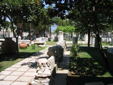
Bodrum
Bodrum (Turkish pronunciation: [ˈbodɾum]) is a district and a port city in Muğla Province, in the southwestern Aegean Region of Turkey. It is located on the southern coast of Bodrum Peninsula, at a point that checks the entry into the Gulf of Gökova,..
Bodrum Wikipedia Page


About Our Data
The data on this page is estimated using a number of publicly available tools and resources. It is provided without warranty, and could contain inaccuracies. Use at your own risk.