Categories in Patnos
Industries
Business Distribution by Industry in Patnos
| Industry Description | Number of Establishments |
|---|---|
| Religion | 36 |
| Gas station | 29 |
| Education | 21 |
| Grocery stores and supermarkets | 20 |
| Shopping | 13 |
| Taxis | 10 |
| Beauty salons | 9 |
| Telecommunications | 8 |
| Household appliances and goods | 7 |
| Corporate management | 7 |
| Wholesalers | 6 |
| Internet cafes | 6 |
| Automotive | 5 |
| Construction of buildings | 5 |
| Hotels and motels | 5 |
Patnos Facts
| Area | 1402.2 km² |
| Population | 132,416 |
| Male Population | 68,920 (52.0%) |
| Female Population | 63,496 (48.0%) |
| Population change (1975 to 2020) | +95.5% |
| Population change (2000 to 2020) | +5.5% |
| Median Age | 17.4 years (Male: 17.5, Female: 17.3) |
| Neighborhoods | Yeni Mahallesi, Atatürk Mahallesi, İnönü Mahallesi, Cami Mahallesi, Alparslan Mahallesi |
| Local Time | |
| Timezone | Türkiye Standard Time |
| Lat & Lng | 39.22493, 42.85693 |
| Postal Codes | 04502, 04510 |
Map of Patnos
Interactive Map
Patnos Population
Years 1975 to 2020
| Data | 1975 | 1990 | 2000 | 2015 | 2020 |
|---|---|---|---|---|---|
| Population | 67,748 | 111,716 | 125,473 | 125,383 | 132,416 |
| Population Density | 48.3 / km² | 79.7 / km² | 89.5 / km² | 89.4 / km² | 94.4 / km² |
Patnos Population change from 2000 to 2015
Decrease of 0.1% from year 2000 to 2015
| Location | Change since 1975 | Change since 1990 | Change since 2000 |
|---|---|---|---|
| Patnos | +85.1% | +12.2% | -0.1% |
| Ağrı Province | +181.3% | +49.8% | +20.4% |
| Turkey | +102.3% | +46.5% | +24.7% |
Patnos Median Age
Median Age: 17.4 years
| Location | Median Age | Median Age (Female) | Median Age (Male) |
|---|---|---|---|
| Patnos | 17.4 yrs | 17.3 yrs | 17.5 yrs |
| Ağrı Province | 19 yrs | 19 yrs | 19 yrs |
| Turkey | 29.3 yrs | 29.8 yrs | 28.7 yrs |
Patnos Population Density
Population Density: 94.4 / km²
| Location | Population | Area | Density |
|---|---|---|---|
| Patnos | 132,416 | 1,402.2 km² | 94.4 / km² |
| Ağrı Province | 569,665 | 11,362.9 km² | 50.1 / km² |
| Turkey | 77.8 million | 780,782.9 km² | 99.6 / km² |
Patnos Historical and Projected Population
Estimated Population from 0 to 2100
- JRC (European Commission's Joint Research Centre) work on the GHS built-up grid
- CIESIN (Center for International Earth Science Information Network)
- [Link] Klein Goldewijk, K., Beusen, A., Doelman, J., and Stehfest, E.: Anthropogenic land use estimates for the Holocene – HYDE 3.2, Earth Syst. Sci. Data, 9, 927–953, https://doi.org/10.5194/essd-9-927-2017, 2017.
Neighborhoods in Patnos
Percentage of businesses by neighborhood in Patnos
Price Distribution
Business distribution by price for Patnos
Human Development Index (HDI)
Statistic composite index of life expectancy, education, and per capita income.
Patnos CO2 Emissions
Carbon Dioxide (CO2) Emissions Per Capita in Tonnes Per Year
| Location | CO2 Emissions | CO2 Emissions Per Capita | CO2 Emissions Intensity |
|---|---|---|---|
| Patnos | 528,488 tn | 3.99 tn | 376.9 tons/km² |
| Ağrı Province | 2,290,832 tn | 4.02 tn | 201.6 tons/km² |
| Turkey | 435,645,812 tn | 5.6 tn | 558 tons/km² |
| 2013 CO2 emissions (tonnes/year) | 528,488 tn |
| 2013 CO2 emissions (tonnes/year) per capita | 3.99 tn |
| 2013 CO2 emissions intensity (tonnes/km²/year) | 376.9 tons/km² |
Natural Hazards Risk
Relative risk out of 10
| Hazard | Risk Level |
|---|---|
| Drought | High (9) |
| Earthquake | High (7.9) |
| Landslide | High (8) |
* Risk, particularly concerning flood or landslide, may not be for the entire area.
- Dilley, M., R.S. Chen, U. Deichmann, A.L. Lerner-Lam, M. Arnold, J. Agwe, P. Buys, O. Kjekstad, B. Lyon, and G. Yetman. 2005. Natural Disaster Hotspots: A Global Risk Analysis. Washington, D.C.: World Bank. https://doi.org/10.1596/0-8213-5930-4.
- Center for Hazards and Risk Research - CHRR - Columbia University, Center for International Earth Science Information Network - CIESIN - Columbia University, and Norwegian Geotechnical Institute - NGI. 2005. Global Landslide Hazard Distribution. Palisades, NY: NASA Socioeconomic Data and Applications Center (SEDAC). https://doi.org/10.7927/H4P848VZ.
- Center for Hazards and Risk Research - CHRR - Columbia University, Center for International Earth Science Information Network - CIESIN - Columbia University, and International Research Institute for Climate and Society - IRI - Columbia University. 2005. Global Drought Hazard Frequency and Distribution. Palisades, NY: NASA Socioeconomic Data and Applications Center (SEDAC). https://doi.org/10.7927/H4VX0DFT.
- Center for Hazards and Risk Research - CHRR - Columbia University, Center for International Earth Science Information Network - CIESIN - Columbia University. 2005. Global Earthquake Hazard Distribution - Peak Ground Acceleration. Palisades, NY: NASA Socioeconomic Data and Applications Center (SEDAC). https://doi.org/10.7927/H4BZ63ZS.
Recent Nearby Earthquakes
Magnitude 3.0 and greater
| Date▼ | Time↕ | Magnitude↕ | Distance↕ | Depth↕ | Location↕ | Link |
|---|---|---|---|---|---|---|
| 2/10/17 | 12:27 PM | 4.5 | 64.7 km | 10,000 m | 7km WSW of Eleskirt, Turkey | usgs.gov |
| 8/25/16 | 4:35 AM | 4.2 | 57.3 km | 10,000 m | 32km E of Adilcevaz, Turkey | usgs.gov |
| 6/23/15 | 10:35 PM | 4.5 | 65.9 km | 5,000 m | 27km NW of Van, Turkey | usgs.gov |
| 7/19/14 | 2:24 AM | 4 | 72.4 km | 5,000 m | 23km NNW of Sarmansuyu, Turkey | usgs.gov |
| 3/5/14 | 12:03 PM | 3.9 | 67.8 km | 5,000 m | 26km NW of Van, Turkey | usgs.gov |
| 11/22/13 | 3:29 AM | 4.4 | 68.9 km | 5,000 m | 24km NW of Van, Turkey | usgs.gov |
| 10/30/13 | 10:40 PM | 4 | 67.1 km | 5,000 m | 26km NNW of Van, Turkey | usgs.gov |
| 1/22/13 | 8:04 PM | 4 | 71.4 km | 2,100 m | eastern Turkey | usgs.gov |
| 11/10/12 | 11:00 AM | 4.1 | 67.4 km | 5,000 m | eastern Turkey | usgs.gov |
| 9/23/12 | 9:10 AM | 4.1 | 66.6 km | 5,000 m | eastern Turkey | usgs.gov |
Patnos
Patnos (Armenian: Բադնոց, Latin transliteration: Badnoc‘ or Patnoc‘, Kurdish: Panos ) was a historically important Armenian city, is now a district of Ağrı Province of Turkey on a plain surrounded by high mountains including Süphan, watered by tribut..
Patnos Wikipedia Page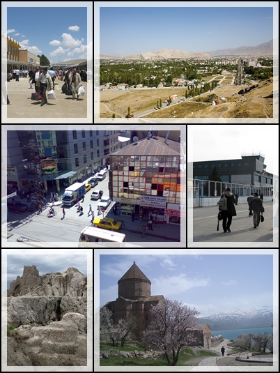

About Our Data
The data on this page is estimated using a number of publicly available tools and resources. It is provided without warranty, and could contain inaccuracies. Use at your own risk.