Categories in Cabimas
Industries
Business Distribution by Industry in Cabimas
| Industry Description | Number of Establishments |
|---|---|
| Grocery stores and supermarkets | 281 |
| Restaurants | 280 |
| Shopping | 217 |
| Education | 135 |
| Bakeries | 120 |
| Car repair | 96 |
| Churches | 83 |
| Car parts | 73 |
| Cafes | 61 |
| Pharmacies and drug stores | 57 |
| Clothing stores | 56 |
| Corporate management | 55 |
| Hardware store | 54 |
Cabimas Facts
| Area | 474.9 km² |
| Population | 321,779 |
| Male Population | 158,639 (49.3%) |
| Female Population | 163,140 (50.7%) |
| Population change (1975 to 2020) | +160.6% |
| Population change (2000 to 2020) | +35.6% |
| Median Age | 27 years (Male: 26.1, Female: 27.8) |
| Area Codes | 264, 279 |
| Neighborhoods | Parroquia Ambrosio, Parroquia Carmen Herrera, Parroquia German Rios Linares, Parroquia La Rosa, Parroquia San Benito |
| Local Time | |
| Timezone | Venezuela Time |
| Lat & Lng | 10.38828, -71.43993 |
| Postal Codes | 4013 |
Map of Cabimas
Interactive Map
Cabimas Population
Years 1975 to 2020
| Data | 1975 | 1990 | 2000 | 2015 | 2020 |
|---|---|---|---|---|---|
| Population | 123,485 | 190,685 | 237,262 | 298,472 | 321,779 |
| Population Density | 260 / km² | 401.5 / km² | 499.6 / km² | 628.4 / km² | 677.5 / km² |
Cabimas Population change from 2000 to 2015
Increase of 25.8% from year 2000 to 2015
| Location | Change since 1975 | Change since 1990 | Change since 2000 |
|---|---|---|---|
| Cabimas | +141.7% | +56.5% | +25.8% |
| Zulia | +194.2% | +79.7% | +37.2% |
| Venezuela | +132.7% | +56.6% | +27% |
Cabimas Median Age
Median Age: 27 years
| Location | Median Age | Median Age (Female) | Median Age (Male) |
|---|---|---|---|
| Cabimas | 27 yrs | 27.8 yrs | 26.1 yrs |
| Zulia | 26 yrs | 26.6 yrs | 25.4 yrs |
| Venezuela | 27.3 yrs | 27.9 yrs | 26.6 yrs |
Cabimas Population Density
Population Density: 678 / km²
| Location | Population | Area | Density |
|---|---|---|---|
| Cabimas | 321,779 | 474.9 km² | 678 / km² |
| Zulia | 4.2 million | 44,028 km² | 96.2 / km² |
| Venezuela | 30.8 million | 912,498.1 km² | 33.7 / km² |
Cabimas Historical and Projected Population
Estimated Population from 1850 to 2100
- JRC (European Commission's Joint Research Centre) work on the GHS built-up grid
- CIESIN (Center for International Earth Science Information Network)
- [Link] Klein Goldewijk, K., Beusen, A., Doelman, J., and Stehfest, E.: Anthropogenic land use estimates for the Holocene – HYDE 3.2, Earth Syst. Sci. Data, 9, 927–953, https://doi.org/10.5194/essd-9-927-2017, 2017.
Neighborhoods in Cabimas
Percentage of businesses by neighborhood in Cabimas
Area Codes
Percentage Area Codes used by businesses in Cabimas
Price Distribution
Business distribution by price for Cabimas
Human Development Index (HDI)
Statistic composite index of life expectancy, education, and per capita income.
Cabimas CO2 Emissions
Carbon Dioxide (CO2) Emissions Per Capita in Tonnes Per Year
| Location | CO2 Emissions | CO2 Emissions Per Capita | CO2 Emissions Intensity |
|---|---|---|---|
| Cabimas | 1,696,859 tn | 5.27 tn | 3,572.8 tons/km² |
| Zulia | 22,999,363 tn | 5.43 tn | 522.4 tons/km² |
| Venezuela | 161,060,019 tn | 5.23 tn | 176.5 tons/km² |
| 2013 CO2 emissions (tonnes/year) | 1,696,859 tn |
| 2013 CO2 emissions (tonnes/year) per capita | 5.27 tn |
| 2013 CO2 emissions intensity (tonnes/km²/year) | 3,572.8 tons/km² |
Natural Hazards Risk
Relative risk out of 10
| Hazard | Risk Level |
|---|---|
| Flood | Medium (4) |
| Earthquake | Medium (6) |
* Risk, particularly concerning flood or landslide, may not be for the entire area.
- Dilley, M., R.S. Chen, U. Deichmann, A.L. Lerner-Lam, M. Arnold, J. Agwe, P. Buys, O. Kjekstad, B. Lyon, and G. Yetman. 2005. Natural Disaster Hotspots: A Global Risk Analysis. Washington, D.C.: World Bank. https://doi.org/10.1596/0-8213-5930-4.
- Center for Hazards and Risk Research - CHRR - Columbia University, Center for International Earth Science Information Network - CIESIN - Columbia University. 2005. Global Flood Hazard Frequency and Distribution. Palisades, NY: NASA Socioeconomic Data and Applications Center (SEDAC). https://doi.org/10.7927/H4668B3D.
- Center for Hazards and Risk Research - CHRR - Columbia University, Center for International Earth Science Information Network - CIESIN - Columbia University. 2005. Global Earthquake Hazard Distribution - Peak Ground Acceleration. Palisades, NY: NASA Socioeconomic Data and Applications Center (SEDAC). https://doi.org/10.7927/H4BZ63ZS.
Recent Nearby Earthquakes
Magnitude 3.0 and greater
| Date▼ | Time↕ | Magnitude↕ | Distance↕ | Depth↕ | Location↕ | Link |
|---|---|---|---|---|---|---|
| 10/16/16 | 5:45 PM | 4.3 | 54.6 km | 35,000 m | 3km SSE of Concepcion, Venezuela | usgs.gov |
| 2/9/14 | 6:02 AM | 4.1 | 54.2 km | 30,600 m | 43km WSW of Lagunillas, Venezuela | usgs.gov |
| 2/25/08 | 10:52 AM | 4.4 | 61 km | 9,200 m | Zulia, Venezuela | usgs.gov |
| 2/25/08 | 7:59 AM | 5 | 64 km | 15,400 m | Zulia, Venezuela | usgs.gov |
| 1/29/08 | 4:28 AM | 4.2 | 48.6 km | 29,600 m | Zulia, Venezuela | usgs.gov |
| 9/14/07 | 10:25 AM | 4 | 46 km | 14,000 m | Lago de Maracaibo, Venezuela | usgs.gov |
| 8/4/06 | 1:41 PM | 5.2 | 98 km | 14,600 m | Trujillo, Venezuela | usgs.gov |
| 3/2/06 | 12:48 AM | 4.2 | 78.3 km | 161,700 m | Zulia, Venezuela | usgs.gov |
| 1/3/06 | 10:15 PM | 5 | 75.9 km | 5,800 m | Lago de Maracaibo, Venezuela | usgs.gov |
| 2/20/00 | 4:01 AM | 3.9 | 28.4 km | 10,000 m | Zulia, Venezuela | usgs.gov |
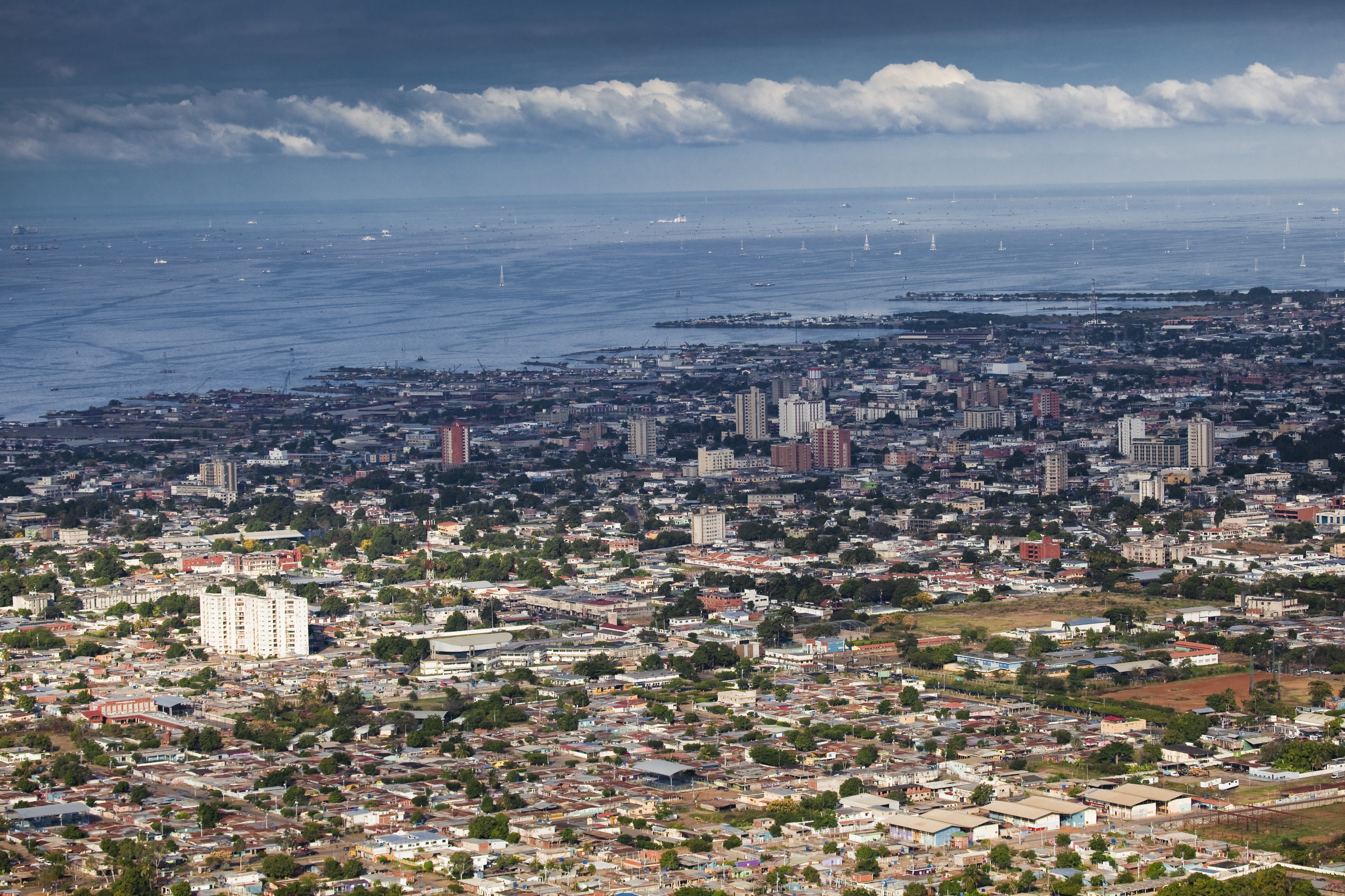
Cabimas
Cabimas is a city on the shore of Maracaibo Lake in Zulia State in northwestern Venezuela. Its current population is around 200,859 (2005). 1900, Venezuela was known to possess commercial quantities of petroleum. One major find was the 'Zumaque 1' w..
Cabimas Wikipedia Page

About Our Data
The data on this page is estimated using a number of publicly available tools and resources. It is provided without warranty, and could contain inaccuracies. Use at your own risk.