Torobayo Facts
| Local Time | |
| Timezone | Chile Standard Time |
| Lat & Lng | -39.84070, -73.27726 |
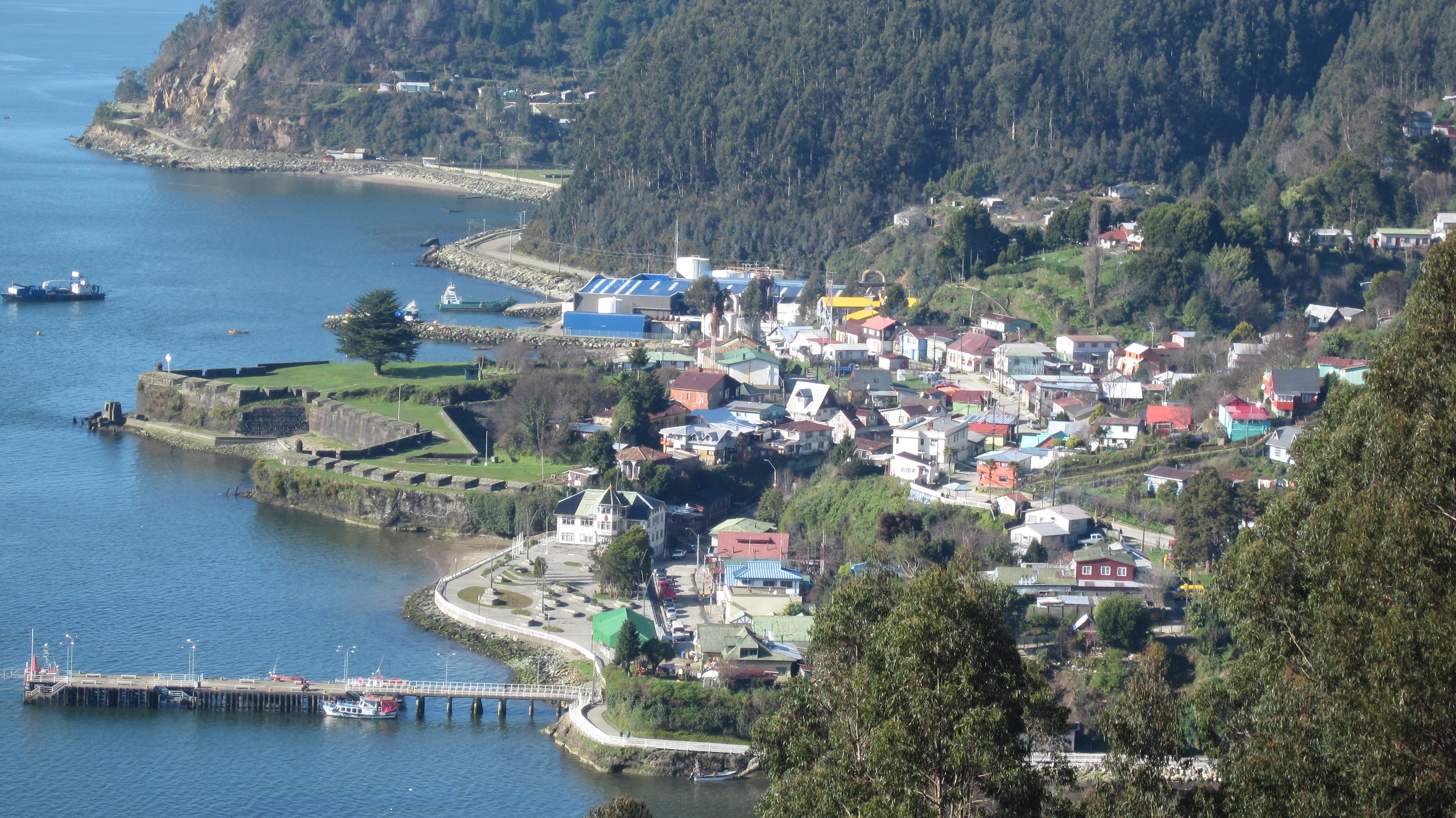
Map of Torobayo
Interactive Map
Recent Nearby Earthquakes
Magnitude 3.0 and greater
| Date▼ | Time↕ | Magnitude↕ | Distance↕ | Depth↕ | Location↕ | Link |
|---|---|---|---|---|---|---|
| 6/8/19 | 1:44 PM | 4.7 | 97.9 km | 89,330 m | 11km WSW of Villarrica, Chile | usgs.gov |
| 5/22/19 | 4:23 AM | 4.6 | 72.2 km | 61,370 m | 13km S of Rio Bueno, Chile | usgs.gov |
| 3/25/19 | 4:32 PM | 4.1 | 76.9 km | 95,920 m | 19km SE of Loncoche, Chile | usgs.gov |
| 1/18/19 | 12:34 PM | 4.3 | 84.9 km | 62,220 m | 7km ESE of Osorno, Chile | usgs.gov |
| 9/19/18 | 11:28 AM | 4.1 | 26.7 km | 60,840 m | 20km ENE of Las Animas, Chile | usgs.gov |
| 12/8/17 | 9:28 AM | 4.1 | 77.5 km | 78,280 m | 27km E of Rio Bueno, Chile | usgs.gov |
| 7/3/17 | 4:45 PM | 4.3 | 90 km | 12,120 m | 49km SW of Carahue, Chile | usgs.gov |
| 5/20/17 | 2:13 PM | 4 | 97.9 km | 10,000 m | 34km SSW of Carahue, Chile | usgs.gov |
| 1/9/17 | 8:08 AM | 4.2 | 49.6 km | 63,130 m | 45km N of Las Animas, Chile | usgs.gov |
| 11/5/16 | 8:21 AM | 4.3 | 48.7 km | 24,430 m | 40km NW of Corral, Chile | usgs.gov |
Source: U.S. Geological Survey (USGS)

About Our Data
The data on this page is estimated using a number of publicly available tools and resources. It is provided without warranty, and could contain inaccuracies. Use at your own risk.